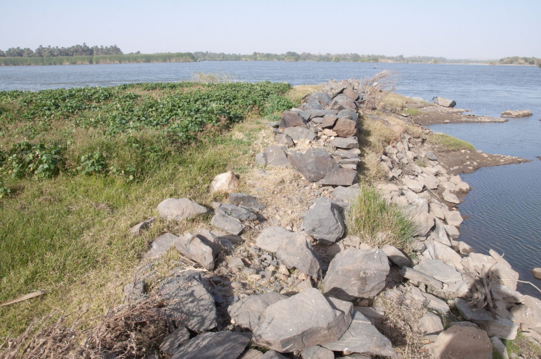
Across Egypt and Sudan, you can find a vast network of stone walls running across the landscape. In a new study, archaeologists detail how some of these ancient structures were constructed by humans over 3,000 years ago and served as an ancient form of hydraulic engineering that tempered the River Nile.
Researchers from the University of Western Australia and the University of Manchester mapped out nearly 1,300 of these so-called “river groynes” using a variety of techniques, including satellite imagery, drones, and ground surveys.
Many of these structures have since been submerged beneath the waters of the Aswan High Dam reservoir, so they also relied on the diaries of 19th-century travelers, a 200-year-old map, and archives of aerial photographs taken by the UK’s Royal Air Force in 1934.
Radiocarbon dating of the structures suggested that some were built over 3,000 years ago and played an important role in the success of ancient Egyptian civilization.

A 20th-century river groyne in northern Sudan, with crops grown on the reclaimed land.
Image credit: University of Western Australia/University of Manchester
The large stone walls – some up to five meters thick and 200 meters long – were used to influence the river flow of the Nile and aided boat navigation through treacherous rapids.
“This incredibly long-lived hydraulic technology played a crucial role in enabling communities to grow food and thrive in the challenging landscapes of Nubia for over 3,000 years,” Dr Matthew Dalton, lead study author from the University of Western Australia, said in a statement.
“These monumental river groynes helped to connect the people of ancient Egypt and Nubia by facilitating the long-distance movement of resources, armies, people, and ideas up and down the Nile,” continued Dalton.
Not all of the walls were made in ancient times, however. The researchers found that this method of river taming is still used today and some of the groynes were built in the 20th century.
“From speaking with farmers in Sudanese Nubia, we also learnt that river groynes continued to be built as recently as the 1970s, and that the land formed by some walls is still cultivated today,” explained Dr Dalton.
The mapping of the walls highlights how much the landscape of Northeast Africa has changed over the past millennia. Many of the river groynes are found in areas that are now barren desert land, indicating that lost rivers once flowed here.
In fact, the researchers suspect that some of the walls were constructed in response to dramatically shifting climate conditions.
“We know that reaches of the Nile in Sudan had multiple channels earlier in the Holocene and many of them dried out when river flows decreased due to climate change,” added study co-author Professor Jamie Woodward of The University of Manchester.
“The occurrence of these walls in channels that dried out thousands of years ago strongly suggests some of this engineering was in response to waning flows and the need to expand the riparian area suitable for agriculture,” Woodward said.
The study is published in the journal Geoarchaeology.
Source Link: Ancient Walls Along River Nile Were A Vast Hydraulic Engineering System