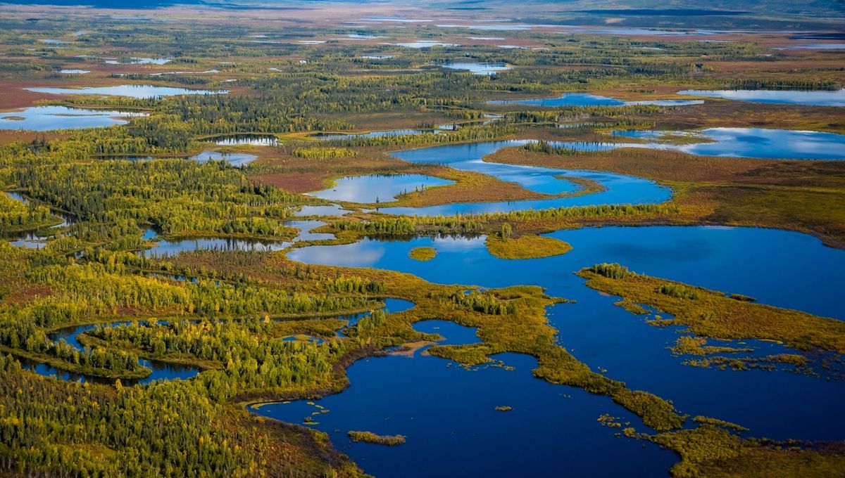
The land bridge across the Bering Strait that lasted through much of the last Ice Age was likely very different from what has been imagined. Instead of a mix of grassland, tundra, and ice sheet, the connection between Asia and North America consisted of boggy wetlands punctuated by rivers and higher ground, a new study has revealed. The findings further complicate the question of when and how the first people made it to the Americas.
The sudden appearance of land-dwelling Asian species in North America – and sometimes the reverse – posed a puzzle to paleontologists for a long time. Eventually, it was recognized that during the last Ice Age, sea levels were so much lower that it was possible to walk on dry land across what is now the Bering Strait, creating an enormous region known as Beringia.
Or at least it was assumed the land was dry. Most of Alaska and the eastern tip of Siberia are sufficiently similar that it was assumed the land in between was much like both – although, of course, the whole region was drastically colder 36,000-11,000 years ago when the two were connected. However, the first collection of sediments of the right age from the seafloor where the bridge once lay has changed that.
“We were looking for several large lakes,” said Professor Sarah Fowell, of the University of Alaska Fairbanks in a statement. “What we actually found was evidence of lots of small lakes and river channels.”
In hindsight, the discovery is not so surprising. The land bridge is now under the ocean, not because it has subsided, but because it is substantially lower than the area on either side, and rising seas have covered it. That lower altitude means that (at least in summer) rivers could have flowed off both continents to collect there. Uneven topography might lead to those rivers feeding the anticipated lakes, but flatter land lets the water spread widely, creating a boggy riverine environment. Fowell and colleagues didn’t even have to look too far for modern counterparts, pointing to one in the Yukon-Kuskokwim Delta.
“We’ve been looking on land to try to reconstruct what is underwater,” said Dr Jenna Hill, of the U.S. Geological Survey. “But that doesn’t really tell you what was on land that is now submerged between Alaska and Siberia.”
Fowell, Hill, and colleagues used the R/V Sikuliaq to collect core samples from the sea floor in areas that had been above sea level at the relevant time, focusing on 36 sites already known to be lower-lying spots. They thought these would have been the lakes of the era. Pollen, DNA, and intact items such as egg cases and leaves give a picture of the surrounding environment at each site. These reveal that some trees flourished, likely on higher ground, but much of the land was boggy, attracting wading birds.
The work has yet to be published, but is so significant it forms the basis of seven papers at this week’s American Geophysical Union Annual Meeting in Washington D.C.
It’s paleogeologists’ job to care about ancient ecosystems anywhere, but there is much wider excitement about knowing how species crossed Beringia, and why some didn’t.
Humans and other animals such as mammoths and bison could cross short stretches of wetland, but hundreds of kilometers were probably a different matter Consequently, the team is confident higher ground provided better opportunities to travel.
“It may have been marshy, but we are still seeing evidence of mammoths,” Fowell said. There was even mammoth DNA at one site. “Even if it was mostly floodplains and ponds, the grazers were around, just uphill following higher, drier areas.”
On the other hand, the need to pick one’s way from one dry outpost to another, sometimes pushing through intervening swamps, makes it easier to understand why wooly rhinos and American camels, among others, never completed the journey. “The watery, wet landscape could have been a barrier for some species, or a pathway for species that actually travel by water,” Hill said. “That’s how this fits into the bigger picture.” The fact that something prevented these animals from making their way has led to the proposed existence of a “Beringian Gap”.
Human arrival in the Americas has been among the most controversial questions in science in recent decades. At the time when the Bering Bridge existed, most of northern North America was covered in ice that would have offered nothing to eat. For a long time, it was thought the first people to cross the bridge made their way south through an ice-free corridor that existed around 14,000 years ago.
Since then, evidence has piled up that there were people in the Americas long before the corridor opened, leading to passionate debate about how the first Americans arrived. Coastal routes, “sea ice highways” and even more direct ocean crossings have been proposed. If being able to cross short watery stretches was an essential requirement of the first part of the journey, this may change how the rest is seen.
Fowell and Hill are each presenting the work they led on Tuesday, December 10. Related research includes a preliminary analysis of two of the Sikuliaq’s cores, an exploration of the time when seawater replaced fresh at one site, and the richness of marine life off Beringia’s coast at the time.
On Friday, December 13, research on how DNA has been used to identify the plants and animals present at the site of two cores 17,000 years ago will be presented.
Source Link: Crossing The Bering Bridge Meant Finding A Path Through Swampy Ground