It’s official: Hurricane Melissa is the strongest storm of 2025. After slowly moving its way to the Caribbean, it rapidly intensified in strength to a Category 5 yesterday morning, and is soon to make landfall in Jamaica, where it’s likely to cause significant damage.
Key takeaways
- Hurricane Melissa has reached Category 5 status, and is the strongest hurricane of 2025 so far.
- Scientists have been busy collecting data on the storm, including one mission into the hurricane’s eye that had to be aborted due to “severe turbulence”.
- The hurricane is due to make landfall in Jamaica today, where it’s likely to be highly destructive.
The strongest storm of the year
Melissa was officially designated as a Category 5 hurricane early on October 27, having rapidly intensified in strength as it headed towards Jamaica. This put it in the highest category on the Saffir-Simpson scale (although some people are arguing for a Category 6), which is used to classify hurricanes based on their maximum sustained wind speed.
For a Category 5, this means speeds above 252 kilometers per hour (157 miles per hour). According to the National Hurricane Center’s (NHC) latest report, Melissa’s current maximum sustained wind speed sits at around 280 km/h (175 mph). This makes it the strongest storm to have hit in 2025.

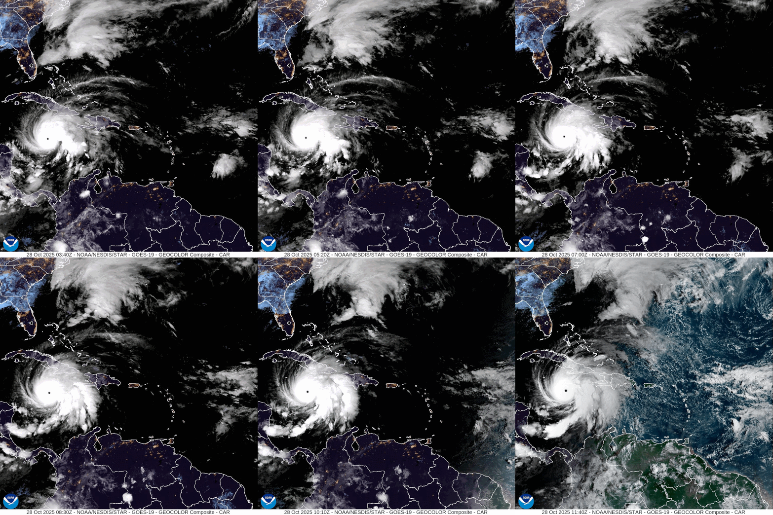
Satellite imagery of the hurricane, as of the early hours of October 28.
Image credit: CIRA/NOAA
While Melissa could easily hold onto this title with the end of the hurricane season in sight, it’s unlikely to be the last storm with such strength in the long term if climate change goals aren’t reached. Scientists have found that global warming appears to have caused tropical cyclones to become more intense, and projected that the proportion reaching Category 4 or 5 status will increase.
It’s a trend that we’re already seeing the effects of. Including Hurricane Melissa, there have been 45 Category 5 hurricanes in the North Atlantic Ocean Basin since 1924; 29 percent (13) of these have occurred in the last 10 years, and Melissa is one of three in this year alone.
Flying into the eye of the storm
If it’s difficult to comprehend just how enormous and powerful hurricanes like Melissa are, look no further than footage taken by the National Oceanic and Atmospheric Administration’s (NOAA) “Hurricane Hunters”. This team of specialist pilots, planes, and scientists fly into storms to collect data for both forecasting and research, and this can involve zooming right into a hurricane’s eye.
Things don’t always go to plan, however. On Monday morning, a hurricane hunter flight had to leave the storm earlier than planned after “experiencing severe turbulence in the southwestern eyewall”, according to an NHC report.
University of Miami Associate Scientist Andy Hazelton was onboard at the time, describing it as a “wild ride” on social media platform X. “My first time ever in a Category 5, and it was definitely the most turbulent I’ve ever experienced. I was processing the dropsonde data and sending it out – some of these are up there with about as strong as Atlantic hurricanes can get.”
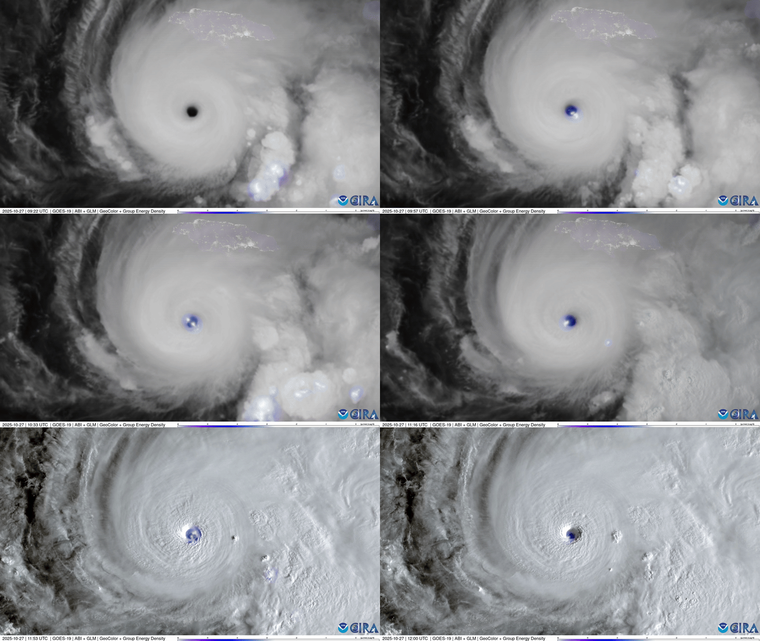
Observations of Hurricane Melissa have been taking place up in space too. In a stunning set of images captured by the GOES-19 satellite on Monday, an intense lightning storm can be seen taking place within the eye of the storm.

That’s a lot of lightning.
Image credit: CSU/CIRA & NOAA
The cost of a Category 5
It’s worth noting that the category of a storm isn’t necessarily indicative of the damage it will cause; Hurricane Katrina, for example, was a Category 3 when it made landfall on the mainland US, and yet it is the costliest hurricane ever to have hit the country at over $200 billion.
Still, with many predicting that this slow-moving storm could be the strongest ever to hit Jamaica, where it’s due to make landfall today, it’s likely that Hurricane Melissa is going to have a significant impact.
“Slow-moving major hurricanes often go down in history as some of the deadliest and most destructive storms on record,” AccuWeather Chief Meteorologist Jonathan Porter told Reuters. “This is a dire situation unfolding in slow motion.”
In a public advisory posted on Tuesday morning (October 28), the National Hurricane Center warned that the cyclone is expected to bring “catastrophic” winds to Jamaica, as well as a life threatening storm surge with “large and destructive waves”, and 38 to 76 centimeters (15 to 30 inches) of rainfall that could trigger “catastrophic flash flooding and numerous landslides.”
“It’s a catastrophic situation expected in Jamaica,” the World Meteorological Organization’s tropical cyclone specialist Anne-Claire Fontan said in a press briefing, per Reuters. “For Jamaica, it will be the storm of the century for sure.”
Source Link: Hurricane Melissa Is 2025's Strongest Storm Yet, With Turbulence So Bad It Saw Off The Hurricane Hunters