Lurking deep beneath the ice sheets of Antarctica, gravity-detecting satellites have rooted out the remnants of long-lost continents. Nope, it’s not quite Atlantis, but the discovery is shedding some much-needed light on the mysterious history of Antarctica.
Researchers from Germany’s Kiel University and the British Antarctic Survey discovered the ancient continents in 2018 using gravity-mapping satellite data (the same way we map the seafloor) and bucketloads of seismological information, which picked up on a patchwork of ancient key geological features on the Earth’s lithosphere, the tough outer shell of the planet that consists of the crust and upper mantle.
“These gravity images are revolutionizing our ability to study the least understood continent on Earth, Antarctica,” co-author Fausto Ferraccioli, science leader of geology and geophysics at the British Antarctic Survey, said in a statement.
Much of the data came from the European Space Agency’s Gravity field and Ocean Circulation Explorer (GOCE) satellite that cruised the planet between 2009 and 2013, on a mission to measure the pull of Earth’s gravity field in unprecedented detail.
Five years before the discovery, GOCE made an uncontrolled reentry to Earth’s atmosphere before disintegrating near the Falkland Islands in the South Atlantic Ocean. Fortunately, all of its precious data had made it safely back home before then.
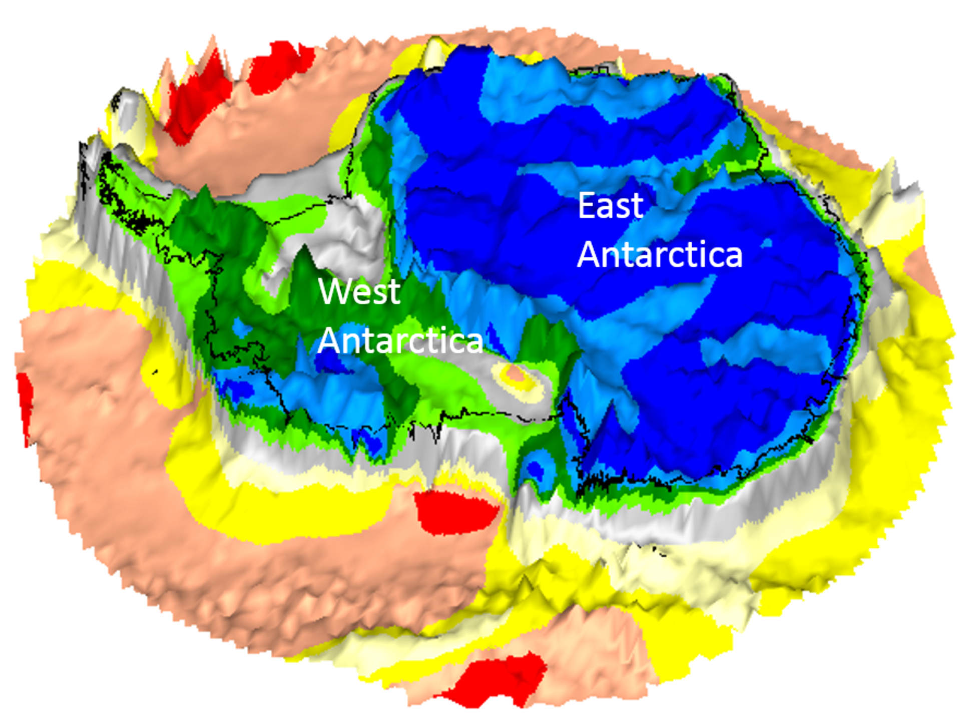
GOCE map of Antarctica on bedrock topography.
Image credit: Kiel University/BAS
Writing in the journal Scientific Reports in 2018, the team explained how they used GOCE data about how rapidly the acceleration of gravity changes, known as localized gravity gradients, as well as information about the differences in horizontal and vertical components of the gravity field. Together with seismological data for the planet, they were able to build up three-dimensional images of Earth’s plate tectonics, even in hard-to-reach areas buried beneath kilometers of ice, like Antarctica.
It also revealed how West Antarctica has a notably thinner crust and lithosphere compared to East Antarctica, made up of mountainous folded plate crumples (known as orogen) and ancient stable rocky zones of the Earth’s crust (called cratons).
Within these rocky craton-rich zones, it’s possible to see the remnants of ancient continents that have been smushed within the depths of modern continental plates.
“In East Antarctica, we see an exciting mosaic of geological features that reveal fundamental similarities and differences between the crust beneath Antarctica and other continents it was joined to until 160 million years ago,” noted Ferraccioli.
The cratons are also particularly interesting as they make up the oldest cores of Earth’s lithosphere, therefore they can be studied to unearth insights into the planet’s early history.
“It also provides context of how continents were possibly connected in the past before they drifted apart owing to plate motion,” ESA’s GOCE mission scientist Roger Haagmans added.
An earlier version of this article was published in November 2018.
Source Link: Long-Lost Remnants Of Ancient Continents Still Lurk Beneath Antarctica
