Ever wanted to know more about the ground beneath your feet? Well, thanks to a new geologic map of the lower 48 states of the USA, now you can – and in more detail than ever before.
The rest of this article is behind a paywall. Please sign in or subscribe to access the full content.
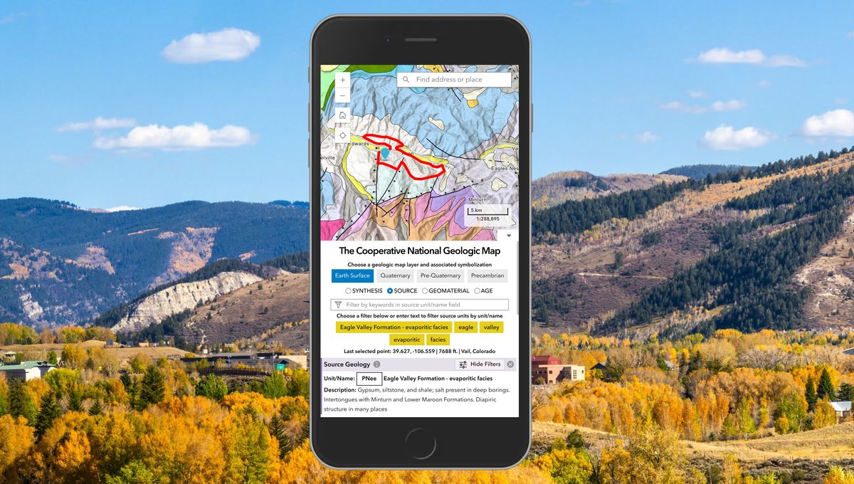
Geologic maps are pretty much what they say on the tin: maps detailing an area’s geological features, such as different types of rocks and sediments, their age, and how they’re distributed. They’re used in all sorts of ways, not just by geologists wanting to double-check how old a rock formation is, but also in understanding more about possible geological resources – like minerals – and natural hazards such as earthquakes.
That’s why making sure that they contain as much detail as they possibly can is so important – and the US Geological Survey (USGS) appears to have achieved that in its newly-released geologic map of the lower 48 states, dubbed The Cooperative National Geologic Map.
Cooperative is an appropriate name: creating such a detailed map required the help of multiple different sources, which provided over 100 preexisting geologic maps created by both the USGS and individual state geological surveys.
All that data sounds like it would take a long time to compile, and traditionally, it has. But using a new method involving automation, the team behind the map was able to create it, and the interface that allows users to interact with it, in just three years.
“Ongoing mapping efforts continually make new discoveries, but past national maps took decades to create while our new method allows us to update our national map faster than ever possible before,” said Sam Johnstone, a USGS research geologist and lead developer for the mapping project, in a statement.
The result is a map that allows you to pinpoint a single location in the mainland US, and explore its geological data – and where that data came from – through the surface of the Earth and the layers of rock below. This includes rock that formed during the Precambrian era, the earliest part of Earth’s history spanning from 4.5 billion to 541 million years ago, before life exploded.
While geologic maps have their professional uses, this particular map has also been designed with the public in mind, accessible to anyone who’s interested in finding out more about the country’s geological history – like how old the rock beneath your own backyard is.
“This map provides complete, analysis-ready geologic data for the nation, in a format that is easy to expand going forward,” said Joseph Colgan, a USGS research geologist and leader of the team that created the map. “By providing this map online, we aim to enhance educational engagement and foster a greater public appreciation of geology.”
Source Link: Most Detailed Geologic Map Of The US To Date Lets You Explore Country’s Ancient History