Hurricane Milton made landfall last night as a Category 3 storm, causing destruction on Florida’s west coast and leaving millions without power.
For a brief time, the intense storm was Category 5, with Fox 35 Orlando meteorologist Noah Bergren describing it as “nearing the mathematical limit of what Earth’s atmosphere over this ocean water can produce”.
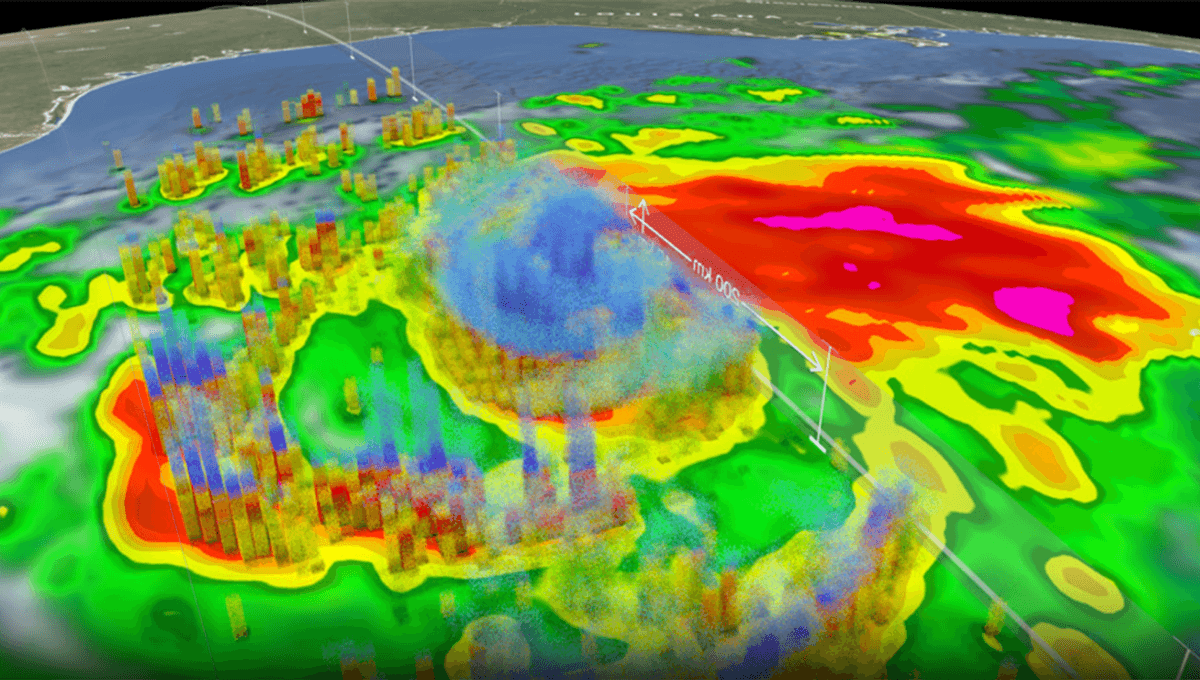
In a NASA animation, the agency explains how the storm came to be so strong.
As explained by the space agency, the storm underwent a “remarkable period of rapid intensification” after forming in the Bay of Campeche. Winds increased from 56 kilometers per hour (35 miles per hour) to 257 kilometers per hour (160 miles per hour) in just 48 hours, as the central pressure fell dramatically.
“Milton’s formation appears to have been influenced by the Central American gyre, a seasonal area of low-pressure centered over Central America that results in a large-scale counterclockwise or cyclonic flow that can extend over the western Caribbean, southern Gulf of Mexico, including the Bay of Campeche, and far eastern Pacific,” NASA’s Scientific Visualization Studio explained in an accompanying post.
“After a trough of low pressure rotated from the southeastern into the southwestern Gulf, thunderstorm activity began to consolidate in the southwestern Gulf in the Bay of Campeche. Persistent thunderstorm activity in this area then led to the formation of an area of low pressure, and by 10:00 am CDT on October 5th, the National Hurricane Center (NHC) determined that thunderstorm activity associated with this low was sufficiently organized to be classified a tropical depression.”
Monitoring the depression, NASA watched as it strengthened and became a hurricane. The organization has kept a close eye on the large 10-kilometer (6-mile) “towers” within the storm, as well as the intense surface rain.
“Together these indicate intense thunderstorm activity is occurring in the northern eyewall. This results in large amounts of heat being released into the core of the storm and is usually a good indication of further strengthening.”
Overall, the strength of the hurricane, and its intensification, were due to unusual activity in the water below it.
“The hurricane’s rapid intensification to a Category 5 was fueled by unusually warm water in the Gulf of Mexico,” NASA explained on X, adding, “human-driven warming is linked to stronger and more rapidly intensifying hurricanes.”
Source Link: NASA Animation Shows How Hurricane Milton Became So Intense