This year Pakistan has experienced some of the most extreme weather events of the unfolding climate crisis. The region experienced a record-breaking heatwave in the spring, with areas reaching 47°C (116.6°F), followed by the worst flooding it’s seen in a decade. One-third of the country, an area equivalent to the state of Colorado or half the size of France, is currently underwater, according to its climate minister, as these eye-opening satellite images show.
The latest space observations from the European Space Agency’s Copernicus Sentinel-1 (above) show just how much of the country has been affected. The radar observations can penetrate through the Moonsoon clouds that have poured more than ten times the usual rainfall on the country.
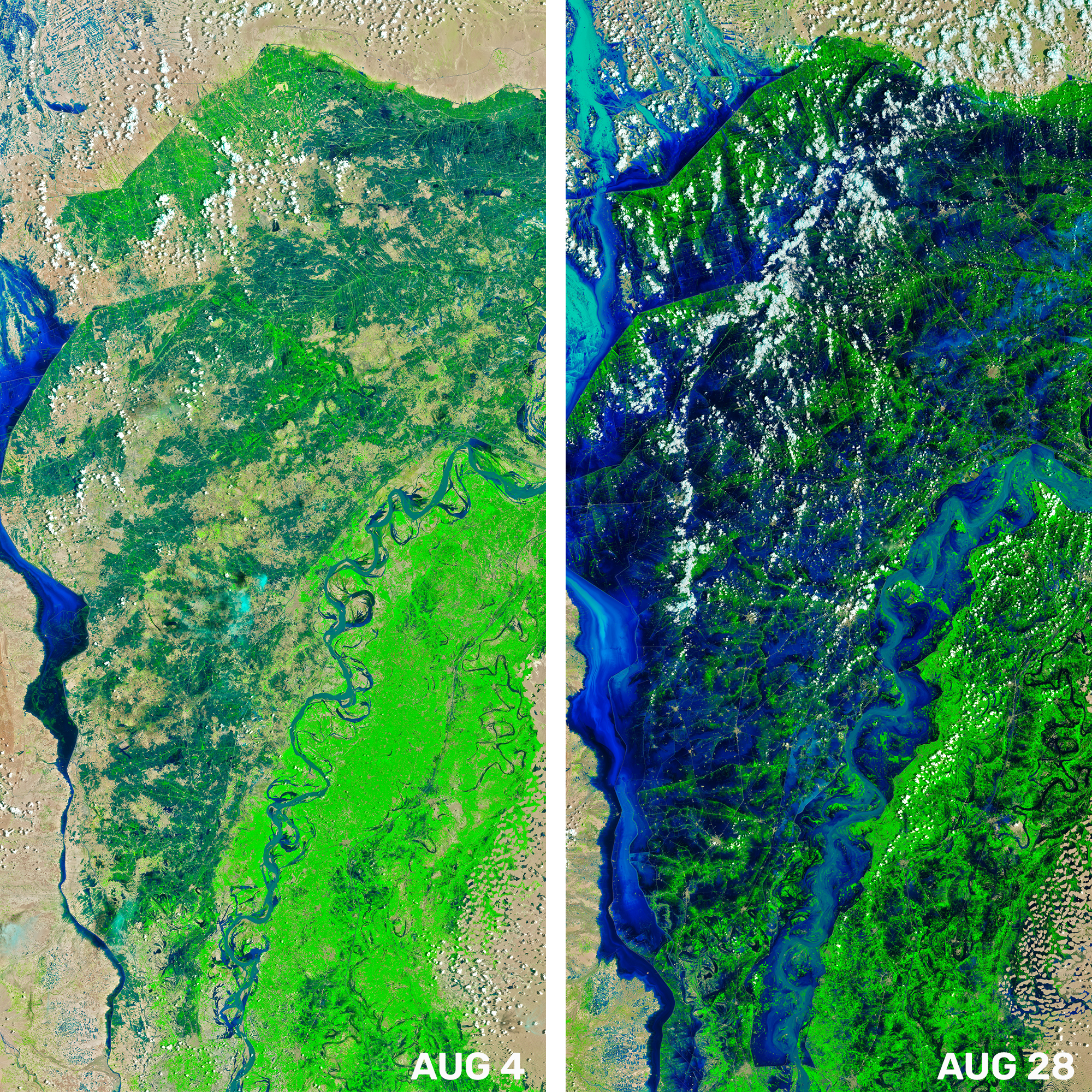
In the NASA Earth Observatory images below, the Indus river has turned into a lake. The Qambar and Shikarpur districts shown have received 500 percent more rainfall than average between July 31 and August 31.

The Indus river is clearly seen in the left image, which has now become a vast lake, as seen by the Landsat 8 and 9 satellites in August 2022. Image credit: NASA Earth Observatory, Joshua Stevens
According to reports, over 33 million people, half of them children, have been affected by the floods. Over 1,100 people have perished in the deluge. Pakistan Prime Minister, Shehbaz Sharif, estimated that the repair of infrastructure alone would cost $10 billion.
Many have pointed out that while Pakistan has experienced some of the most extreme climate change-related weather events ever recorded, it is responsible for a tiny fraction of the greenhouse gas emissions that exacerbate these extreme weather events. There have been calls for the international community, especially the largest polluters, to do more to support countries that contributed very little to climate change but are now experiencing the worst effects of the unfolding crisis.
Source Link: Satellite Images Reveal Pakistan Flood Devastation As One-Third Of Country Is Underwater