How much does a forest weigh? This sounds like a philosophical question, but we will be able to answer it soon thanks to the European Space Agency’s Biomass spacecraft. The mission possesses a special radar that can map woodland areas from space. Now, it has released its first-ever images, and they cover more than just forests.
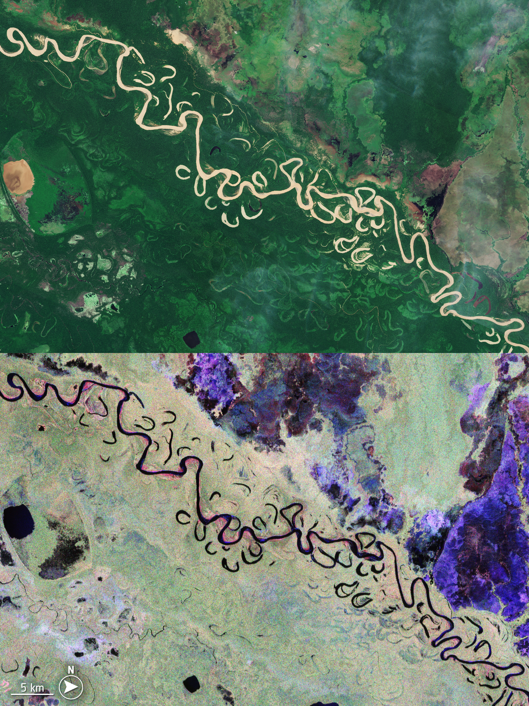
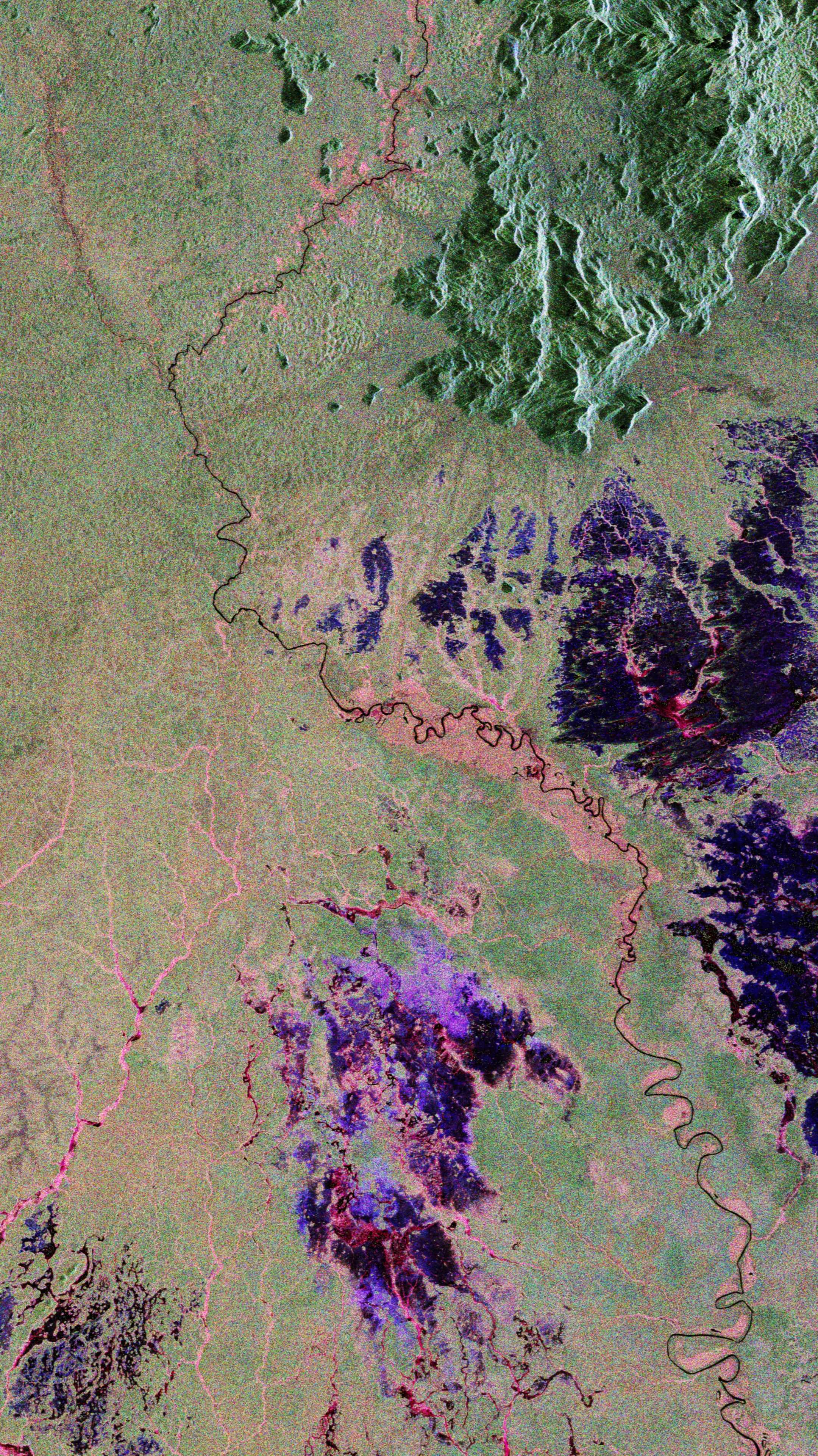
The first images cover areas of Bolivia, Brazil, Indonesia, Gabon, as well as the desert in Chad and glaciers in Antarctica. Biomass is equipped with a radar that allows it to penetrate the canopy of dense forests to measure the wood structures underneath, with the new images showcasing that it can also map lower vegetation, the presence of wetlands (like the red and pink hues in the image from Bolivia, Brazil, and Gabon), and get down all the way to the forest floor.

A comparison of a photo from the Sentinel-2 satellite and how Biomass can penetrate the thick canopy of the rainforest and see the vegetation below, especially around meanders and oxbow lakes.
Image credit: ESA
“As is routine, we’re still in the commissioning phase, fine-tuning the satellite to ensure it delivers the highest quality data for scientists to accurately determine how much carbon is stored in the world’s forests,” ESA’s Biomass Project Manager, Michael Fehringer, said in a statement.
“Biomass is equipped with novel space technology, so we’ve been closely monitoring its performance in orbit, and we’re very pleased to report that everything is functioning smoothly and its first images are nothing short of spectacular – and they’re only a mere glimpse of what is still to come.”

Portion of the Amazon rainforest in northern Brazil. The reds and pinks are lower vegetation, while the greens are trees.
Image credit: ESA
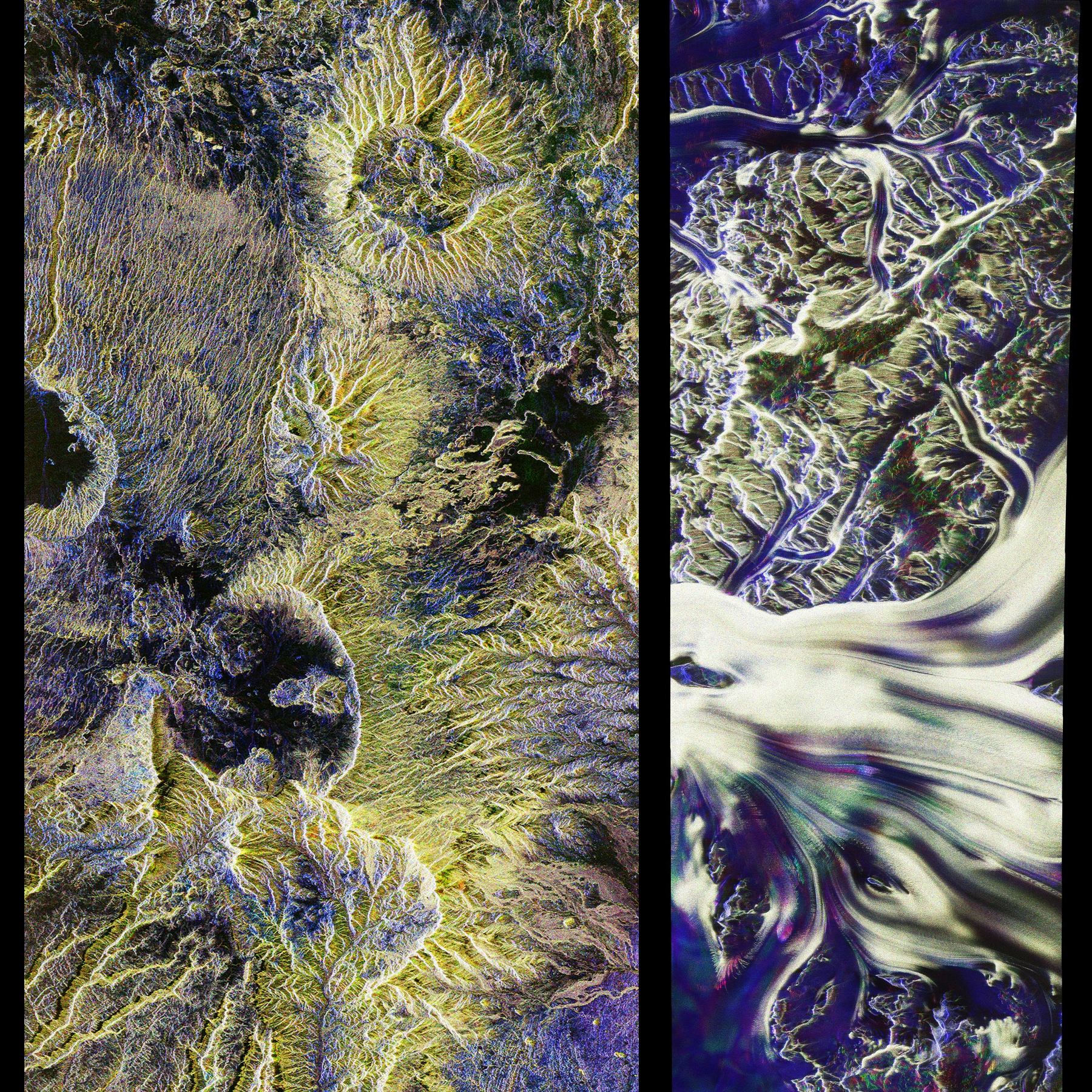
But it is not just forests that Biomass can detect. The radar system is so good that it can see under up to 5 meters (16.4 feet) of dry sand, as the images from the Sahara in Chad demonstrate, revealing where ancient riverbeds used to flow from the Tibesti Mountains before the desert expanded. It also reveals that it can penetrate the ice of glaciers, providing valuable information about the movement of the ice. Not bad, for a mission whose focus is forests and vegetation.
“Looking at these first images, it’s clear to see that our Earth Explorer Biomass satellite is set to deliver on its promise,” ESA’s Director of Earth Observation Programmes, Simonetta Cheli, added.
“We fully expect that this new mission will provide a groundbreaking leap in our ability to understand Earth’s forests – combining cutting-edge radar technology with the scientific excellence that will unlock vital insights into carbon storage, climate change, and the health of our planet’s precious forest ecosystems.”

Portion of the Sahara in Chad (left) and glaciers in Antarctica (right). Biomass doesn’t just see under trees!
Image credit: ESA
Biomass is expected to operate for at least five years and to dramatically expand our understanding of carbon storage and the health of forests, as well as how these are changing over time.
Source Link: See Incredible First Images From Space Mission That Will Weigh All The World’s Forests