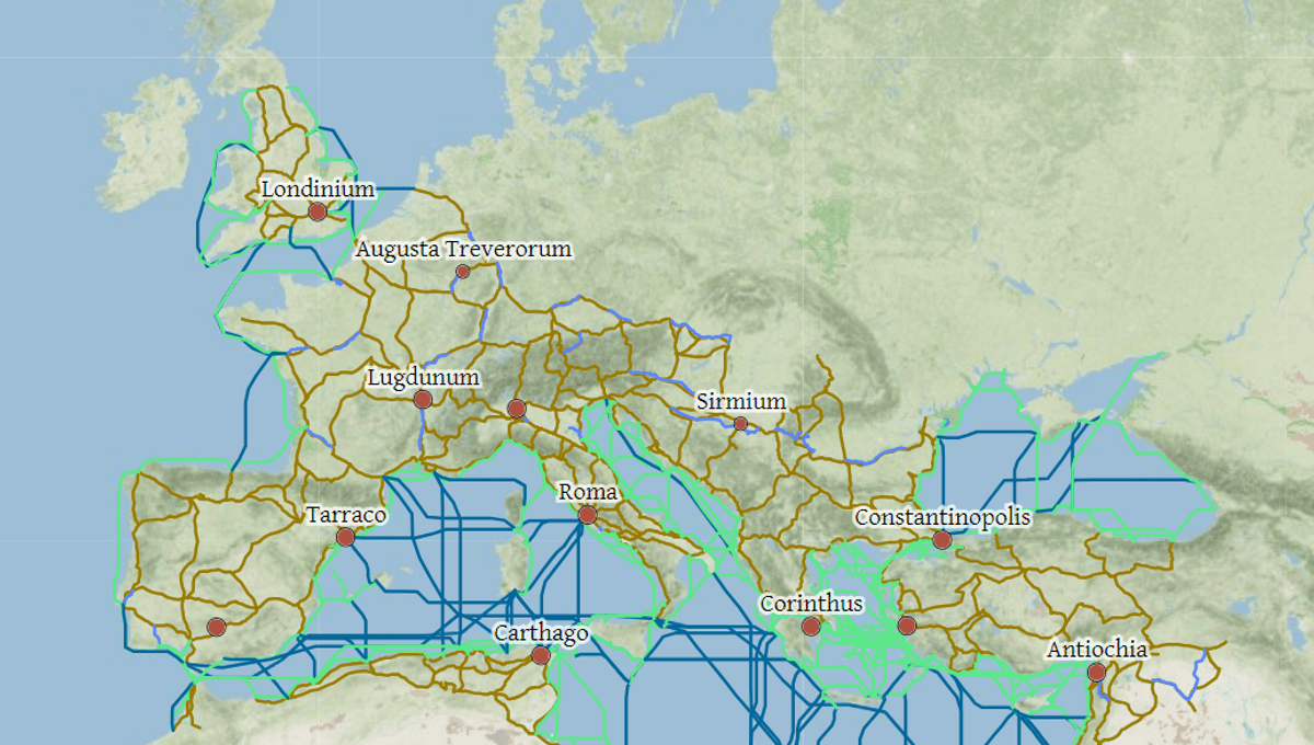
Salvē! We bring great news if you’re a time traveler of the Roman Empire hoping to find your way back to the motherland from Londinium. This brilliantly crafted interactive map shows the ancient roads, sea passages, and trade routes that connected the vast expanse of the Roman Empire.
The map – called ORBIS: The Stanford Geospatial Network Model of the Roman World – was designed by historians at Stanford University with a group of IT specialists and students. You can give it a whirl at the link: https://orbis.stanford.edu/.
The map depicts the lay of the land around 200 CE at the end of the century when the Roman Empire had reached its greatest extent, spanning across much of Europe, as well as significant portions of western Asia and northern Africa.
All you need to do is plug in a location and the point on the map you wish to travel to. It details 632 Roman sites, including important urban settlements or seaports, plus 84,631 kilometers (52,587 miles) of road or desert tracks and 28,272 kilometers (17,567 miles) of navigable rivers and canals.
That’s not even included its 1,026 sea routes, which users can travel between using two speeds that reflect the range of sailing capabilities in the Roman period.
The interactive features of the map are unbelievably detailed. Users can take a variety of different routes to their destination depending on whether they want the cheapest journey available, the shortest, or the fastest. It will also take into account whether you’re traveling by donkey, wagon, or as a passenger in a carriage. Lastly, it will consider the weather and the time of the year.
For instance, a journey from Londinium in Britain to Alexandria in Eygpt during the height of winter by wagon will take 48.4 days with the fastest route, but only 42.5 days in summer. To make this journey during winter with the cheapest options available, it will take up to 93.3 days.
By bringing ancient history into the modern age, the easy-to-use map is a perfect teaching tool for classrooms. Beyond schools, it has even been used for a number of different academic studies about travel across the Roman Empire.
“Our model seeks to improve our understanding of how a large-scale system such as the Roman Empire worked, of the effort it took to succeed in the struggle to connect and control tens of millions of people across hundreds and thousands of miles of land and sea,” the creators explain on their website.
“Taking account of seasonal variation and accommodating a wide range of modes and means of transport, ORBIS reveals the true shape of the Roman world and provides a unique resource for our understanding of premodern history,” they added.
Source Link: See The World Like A Roman With This Brilliant Interactive Map