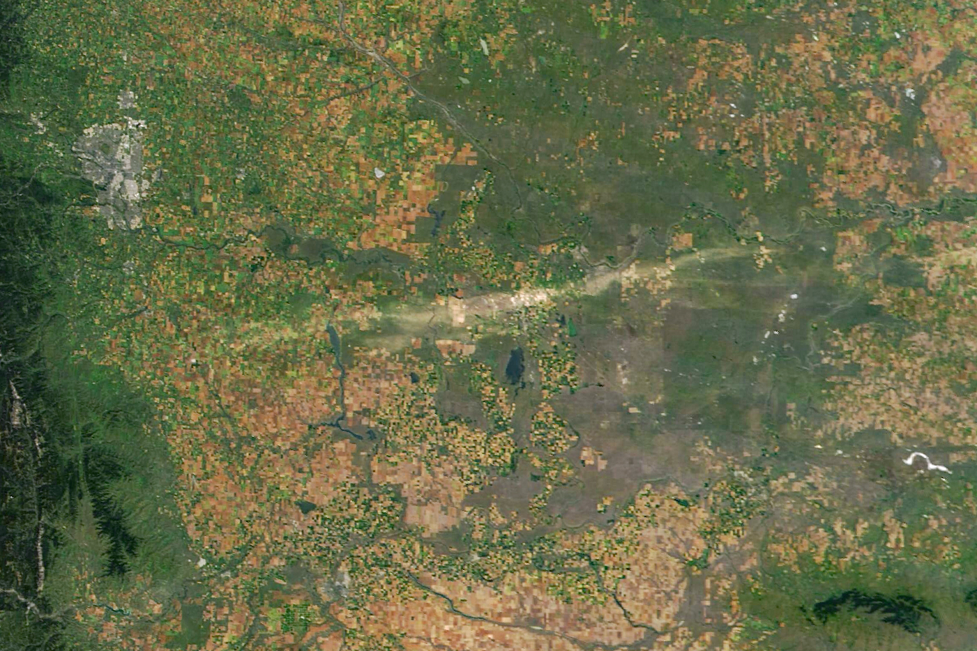
A destructive hailstorm has literally made its mark on southern Alberta, Canada, after pummeling the region with golf ball-sized hailstones, leaving a 200-kilometer-long, 15-kilometer-wide (124-mile-long, 9-mile-wide) “scar” across the landscape that’s been captured in satellite images.
The rest of this article is behind a paywall. Please sign in or subscribe to access the full content.
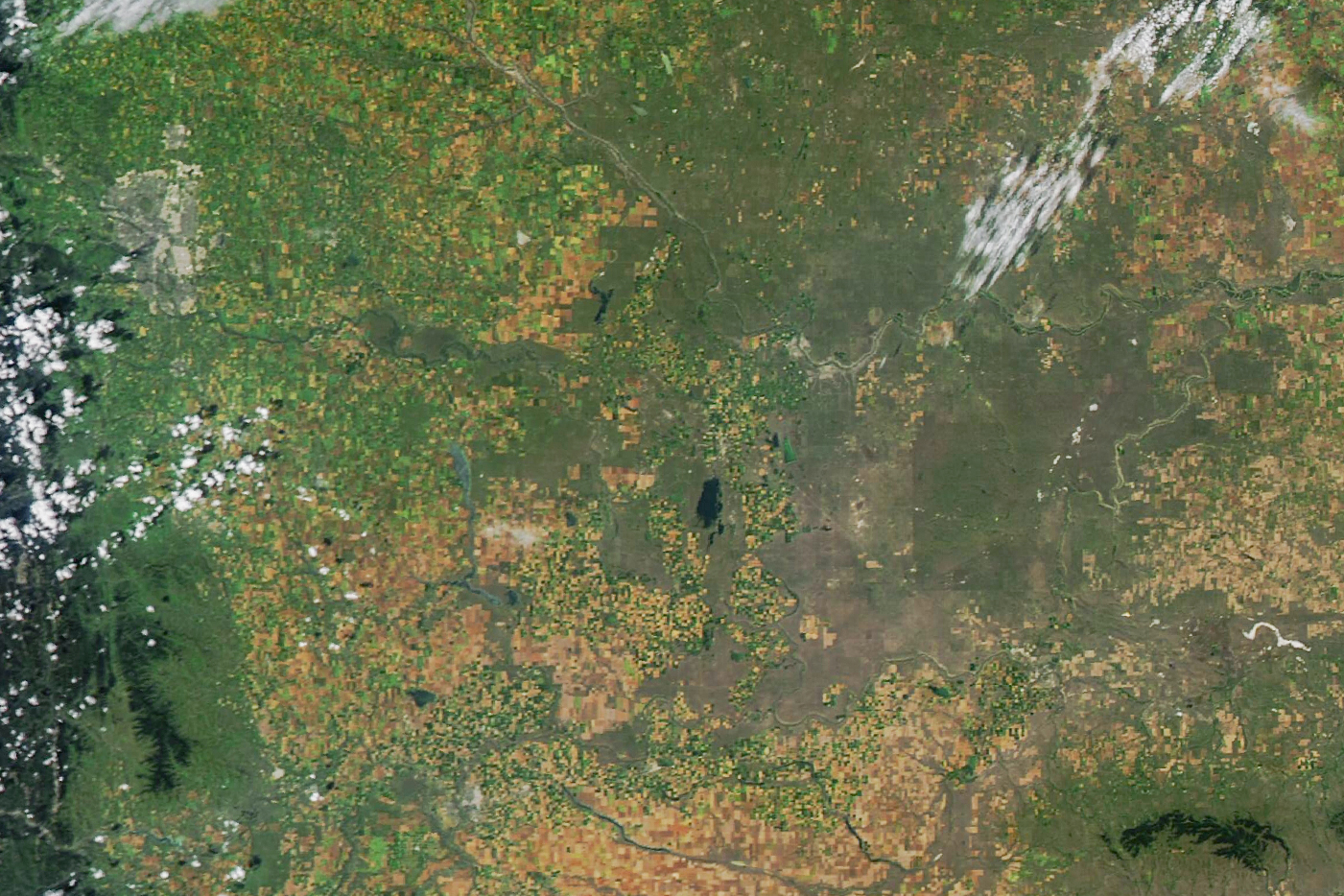
Shared by NASA Earth Observatory, a satellite image taken on August 19 shows all looking well just southeast of Calgary, with an untouched mix of farmland and green areas. Then, on the night of August 20, what Environment and Climate Change Canada (ECCC) Weather Alberta described as a “strong supercell thunderstorm” swept across southern Alberta in just 4 hours.

Before the storm. That patch of grey up near the top left is Calgary.
Image credit: NASA Earth Observatory images by Michala Garrison, using MODIS data from NASA EOSDIS LANCE and GIBS/Worldview
Alongside gusts reaching over 130 kilometers per hour (81 miles per hour), the storm brought with it a blitz of massive hailstones.
Hail is a type of precipitation (the fancy name for water falling from the sky) made up of solid ice, formed when a thunderstorm’s updraft (a rising column of warm, moist air) carries up raindrops to cooler parts of the atmosphere, where they freeze. Once the weight of the hail can no longer be supported by the storm’s updraft, it falls.
And as the storm of August 21 shows, when hailstones fall in combination with strong winds, the results can be incredibly damaging. The scale of the destruction can be seen in satellite imagery from August 24. Taken over the same region as the pre-storm image from August 19, the more recent image shows a visible hail scar over the region, a streak of beige across the otherwise green area of grass and forested land.

After the storm, on August 24.
Image credit: NASA Earth Observatory images by Michala Garrison, using MODIS data from NASA EOSDIS LANCE and GIBS/Worldview
What does that look like down on the ground? “The whole front of the house is destroyed,” Brooks resident Colleen Foisy told CBC News. “The front fence actually got ripped off of the cemented posts. My flowers in my garden got thrown around, branches from the trees. There’s hail damage all over my truck that’s only a year old. The cover to my boat got shredded.”
Elsewhere, the hailstorm tore through farmland, ripping through crops and causing injury to animals. Some insurance providers have estimated that the damage to crops alone is likely to cost millions of dollars.
Unfortunately for those affected by this destructive hailstorm, it’s unlikely to be the last one that they’ll see. This region area of Alberta has been dubbed “Hailstorm Alley” due to the frequency with which it experiences hail, with at least one major hailstorm hitting Alberta every year for the last 20 years.
This is the result of Alberta’s geography, sitting in a region that, in the summertime, creates the perfect conditions for a hailstorm. “Alberta’s croplands provide a source of moist air, which is fuel for thunderstorms. When this moist air blows towards the Rocky Mountains, it is forced upwards, which can trigger the development of these storms,” explains The Weather Network. “The higher elevations just east of the mountains mean that the freezing levels is closer to the ground than in other areas, enabling the hail to make it to the ground before melting all the way.”
Source Link: Supercell Storm Leaves 200-Kilometer-Long Hail Scar Across Canada’s “Hailstorm Alley”