Learning more about inaccessible places is often time-consuming, expensive, and comes with a multitude of other challenges. While technologies can be adapted to explore Earth’s more remote environments, researchers in Australia have found a perfectly adapted ready-made tool to help them learn more about the ocean floor: sea lions.
“Using animal-borne video and movement data from a benthic predator is a really effective way of mapping diverse benthic habitats across large areas of the seabed,” said first author Nathan Angelakis, a PhD student with The University of Adelaide and the South Australian Research and Development Institute (Aquatic Sciences), in a statement.
Eight female Australian sea lions (Neophoca cinerea) from two colonies were equipped with small, lightweight cameras that were glued to a piece of neoprene which was then glued to the sea lion’s fur. The total weight of all the equipment was less than 1 percent of the sea lion’s body weight, meaning they could swim and move around in a totally normal way.
The sea lions were chosen because they are known to spend a lot of time hunting in a range on habitats on the seabed. They are also an endangered species, so the cameras serve a dual purpose of seeing which habitats are down there and which are important to the sea lions themselves.
“We deployed the instruments on adult females so we could recover the equipment a few days later when they returned to land to nurse their pups,” Angelakis explained. “We used satellite-linked GPS loggers on the sea lions, which meant we could track their position in real-time and knew when they had returned to the colony.”
Over a few days, the sea lions swam normally collecting around 89 hours of recordings from under the sea. From the sea lion films, the researchers managed to identify six benthic habitats from Olive Island and Seal Bay at a depth of between 5 and 110 meters (16-360 feet). The habitats recorded by the sea lions included macroalgae reef, macroalgae meadow, bare sand, sponge/sand, invertebrate reefs, and invertebrate boulders.
However, the team were quick to point out the limitations of the study, as the habitats filmed by the sea lions were different from other known regions of South Australia. They suggest that the sea lions could prefer to travel through one habitat over another or miss other habitats altogether.
“These data are useful both for mapping critical habitats for an endangered species such as the Australian sea lion, and more broadly, for mapping unexplored areas of the seabed,” continued Angelakis.

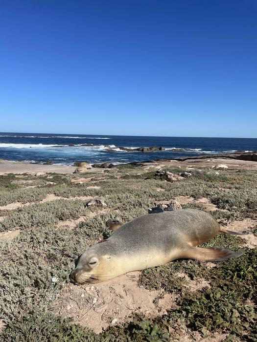
A sea lion scientist with a lightweight camera attached to its back snoozes in the sun after sciencing hard.
Image Credit: Nathan Angelakis
However, the recordings do give the team much greater knowledge of the sea beds and the sea lions themselves, which are classed as endangered. The films can also be used to survey other animals seen in the videos. The team combined the data from the sea lions with oceanographic data to predict habitats on the continental shelf.
“The sea lions from both locations covered quite broad areas around the colonies. In our calculations, we kept the area in which we predicted habitats small to maximize the precision of our predictions,” Angelakis said. “This allowed us to model benthic habitats across more than 5,000 square km [1,930 square miles] of the continental shelf.”
The paper is published in Frontiers in Marine Science.
Source Link: Swim Along With Sea Lion Scientists As They Explore Previously Unmapped Ocean Floor