Believe it or not, this is a photo of sand. At 10 times magnification, sand from the beach at Point Spencer, Alaska, looks like a handful of glittering gemstones. This dazzling, colorful array can tell us much about the history of this wild, remote region.
An ancient crossroads
Nestled between the Kotzebue Sound to the north and the Norton Sound to the south, the Seward Peninsula is home to the westernmost point of the North American continent. Standing at its furthest tip, you would be only 90 kilometers (55 miles) from Siberia. Much of the peninsula is now covered by the Bering Land Bridge National Preserve, the site of the ancient crossroads between two continents.
During the prolonged deep freeze at the end of the Pleistocene Epoch, the drop in sea levels revealed a stretch of land beneath the Bering Strait, a bridge between Asia and North America. Early humans traversed this land bridge in the first waves of migration to the Americas. At that time, the area now known as Point Spencer, far from being a coastal tip, was in fact near the middle of the landmass.
An influx of minerals
Alaska’s coastline in general is a geologist’s dream – whether it be the volcanoes of the Aleutian archipelago or the stunning Kenai Fjords. The Seward Peninsula itself is mountainous, its highest peak reaching 1,437 meters (4,714 feet).
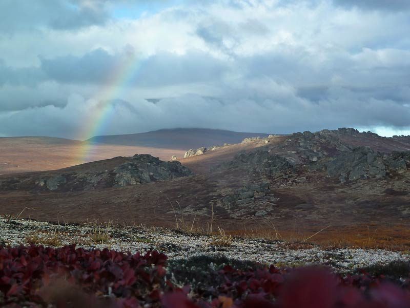
A rainbow over the Serpentine geothermal spring within the Bering Land Bridge National Preserve. Image credit: National Park Service
As the climate warmed and sea levels rose over thousands of years, the coastline around Point Spencer was shaped, and meltwater carried a huge variety of minerals into its surrounding seas – silt from the tundra, volcanic dust from the lava fields, even gold from the mountains. It’s these minerals that give the sand its characteristic jewel tones upon close inspection.
The green color comes from the aptly named olivine. Slightly differing chemical compositions are found in nature, producing crystals in a variety of yellowy-green hues, but perhaps the most famous is peridot – a clear green gemstone often used in jewelry-making.
Glauconite is responsible for the distinctive blue-green colors. It may look pretty, but one of the ways in which this mineral forms is from the fecal pellets of organisms that live on the sea floor. Delightful.
There are also quartzes, with those containing iron oxides appearing orange.
The hidden beauty of these sands is a testament to a complex geological history. It’s no wonder, then, that Xinpei Zhang’s stunning image was awarded the title of Image of Distinction at last year’s Nikon Small World Photomicrography Competition.
Point Spencer today
As remote and forbidding a landscape as it is, Point Spencer has historically been an important trading post for the Iñupiat and Indigenous groups on either side of the Bering Strait. More recently, it was the site of a long-range navigation station operated by the US Coast Guard, including a 414-meter (1,357-foot) radio tower that was – until it was dismantled in 2010 – the tallest structure in the state.
In 2020, ownership of the land was formally transferred to the Iñupiat-owned Bering Straits Native Corp., making good on a years-old promise and securing the future of this land as an important site for development. As the Coast Guard Authorization Act of 2015 says: “It is in the national interest to develop infrastructure at Point Spencer that would aid the Coast Guard in performing its statutory duties and functions in the Arctic on a more permanent basis.”
The story of the land will continue, but the legacy of its formation will always be there, waiting to be discovered, under the microscope.
[H/T: Atlas Obscura]
Source Link: The Jewel-Like Sands Of Alaska’s Point Spencer, Ancient Humans’ Gateway To North America
