Imago Mundi, also known as the “Babylonian Map of the World,” is often said to be the oldest map of the known world ever found. Granted, it isn’t as scientifically accurate as Google Maps, nor as gloriously illustrated as cartography from Medieval times, but it does provide a unique glimpse into the way ancient Babylonians saw themselves and the world around them.
It was likely crafted between 2,600 to 2,900 years ago, a time when the Neo-Babylonian Empire was leading the world in architecture, culture, mathematics, and early forays into science.
The rediscovery of the map in the 19th century is almost as mysterious as the object itself. As per Encyclopedia Britannica, the artifact was discovered by Hormuzd Rassam, a renowned archaeologist who excavated some of the finest Assyrian and Babylonian antiquities ever recovered, including the tablets that contained the Epic of Gilgamesh, the world’s oldest piece of literature.
The Babylonian Map of the World was found in a box related to Rassam’s 1881 excavation at Sippar in present-day Iraq around 40 kilometers (25 miles) southwest of modern Baghdad. However, some believe it may have originally been discovered in Borsippa, another ancient city located about 115 kilometers (70 miles) south of Baghdad. It’s currently in the possession of the British Museum in London.
The cracked tablet measures 12.2 by 8.2 centimeters (4.8 by 3.2 inches) and features a circular map alongside pieces of text written in cuneiform. Given its fractured state, some information is missing from the artifact, although decades of scholarly study have managed to piece together much of its contents.

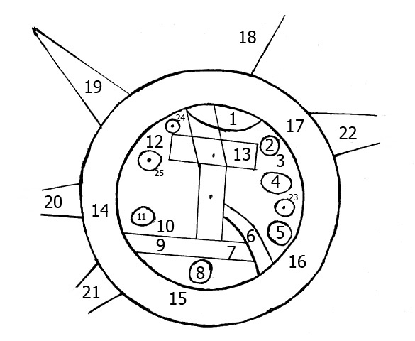
An outline of the objects on the Babylonian Map of the World: Babylon is labeled as 13, while 14 – 17 shows the ocean.
The map depicts Mesopotamia, a historical region in the Middle East often referred to as the “cradle of civilization” because it hosted several prominent civilizations and cultures throughout ancient history, including the Babylonians and Assyrians.
Most believe the city of Babylon is shown in a rectangle strip near the top of the inside of the map (labeled 13 in the illustration above). Parallel lines cut through this rectangle from top to bottom, appearing to represent the Euphrates River. The famous river originates from mountains in the north, passes through Babylon, and then leads into an area of swampy outflow in the south.
We can also find the location of numerous other cities and kingdoms, including Assyria, Der, and Urartu, according to a 1988 paper. All of these settlements are enclosed with a near-perfect circular band that represents “Bitter Water” or “Bitter River,” usually translated as the ocean.
At the top of the map beyond the ocean, it’s labeled as a place “where the Sun is not seen.” Perhaps they believed this was a land of everlasting darkness, just like the strange spaces described in the Epic of Gilgamesh, or maybe this is a cryptic comment about the movement of the Sun.

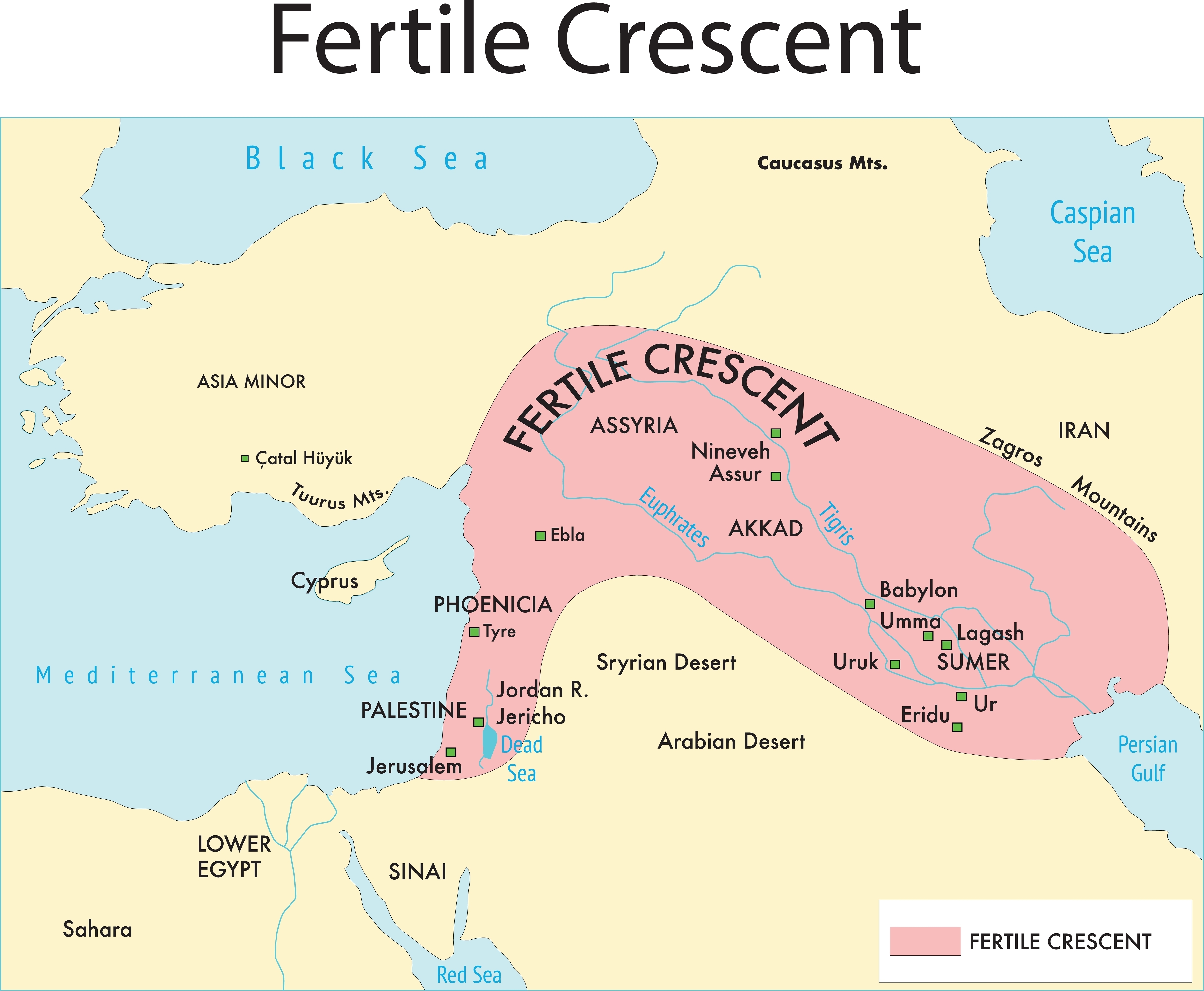
A map showing how this part of the world looking during ancient times.
Image credit: CHAOSPHERE/Shutterstock.com
Part of the text alludes to different monsters and fantastic creatures that live in the different regions, including a winged horse, a great sea serpent, a scorpion-man, and a bull-man. There are also mentions of less surprising beasts, like gazelle, panthers, deer, monkeys, ibex, water buffalo, and wolves.
Human characters inhabit the map too. The text alludes to several different people, including Utnapishtim, the legendary hero who survived the Babylonian flood, and the first ruler of the Akkadian Empire, Sargon.
If you were attempting to navigate West Asia today, it’s safe to say that the Babylonian Map of the World would be pretty useless – the mention of mythical animals would certainly be misleading. However, as a historical document, the object holds many intriguing insights into the dominance of the Neo-Babylonian Empire at the time of its creation.
In the words of British Museum expert Dr Irving Finkel, Babylon is depicted as “awesomely vast in comparison with the other cities on the map”, showing that “the map’s content undoubtedly reflects Babylon as the center of the world.”
Source Link: The Oldest Map Of The Known World Is Filled With Monsters And Mystery