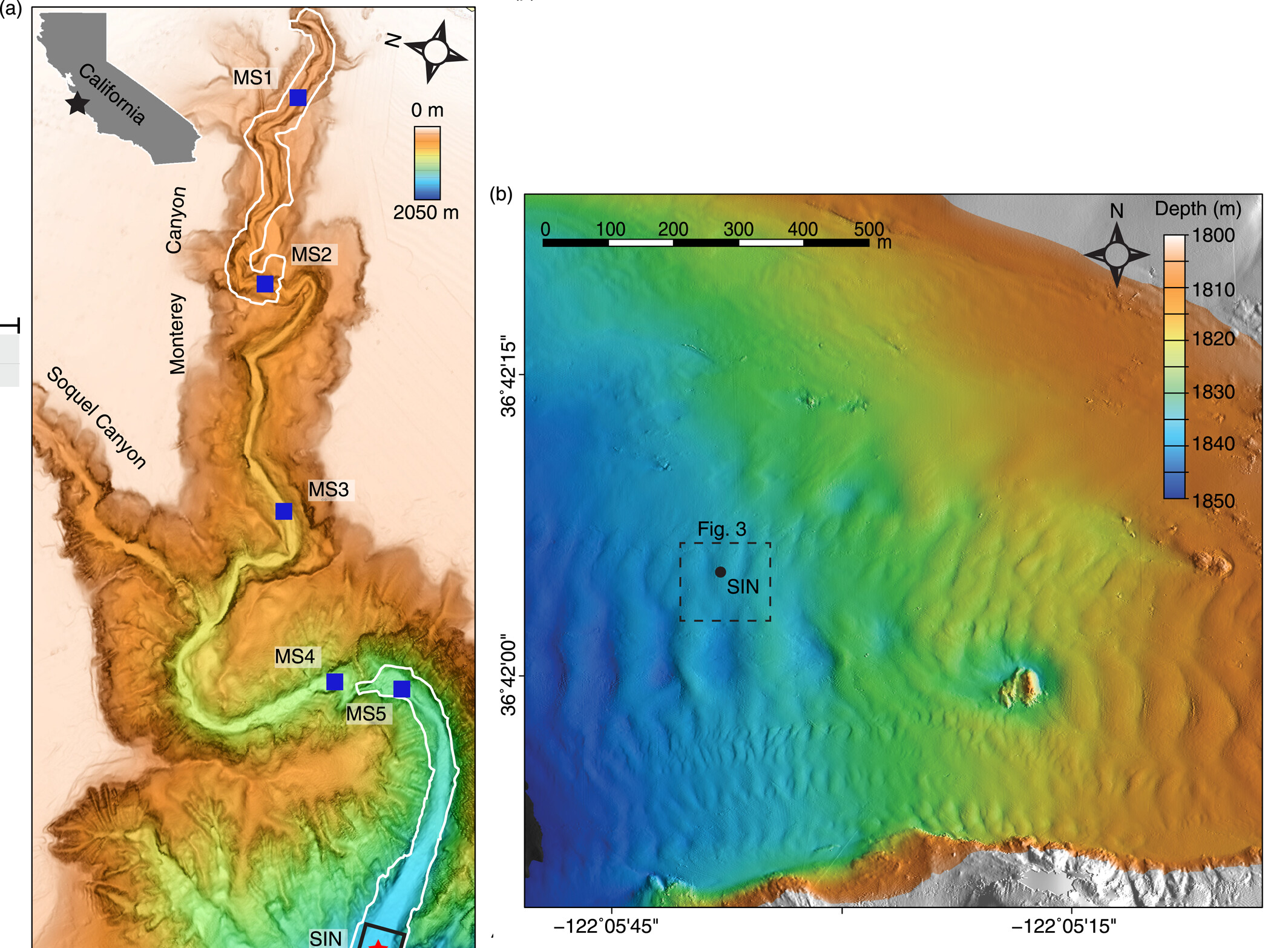
Off the west coast of North America, there’s a vast underwater gorge that rivals the Grand Canyon in both shape and size. Known as the Monterey Canyon, scientists have recently managed to map this submarine colossus to reveal it with never-before-seen clarity.
The Monterey Canyon begins at Moss Landing in California along the middle of the coast of Monterey Bay and stretches out for 153 kilometers (95 miles) under the Pacific Ocean. This is shorter than Arizona’s Grand Canyon, but the Monterey Canyon is significantly deeper, with its deepest pointing plunging 4 kilometers (2.5 miles).
The latest effort to survey this giant geological feature was undertaken by a team from MBARI, the US Geological Survey, Durham University, the University of Hull, and Pontificia Universidad Católica de Chile, who used a cutting-edge sensor suite attached to a remotely operated vehicle (ROV).
Their ROV glides just 3 meters (10 feet) above the seafloor, blasting it with LiDAR and sonar pulses to document its three-dimensional structure with high precision. The data they gathered is so detailed it can pick up on the animals that live down on the seafloor, such as teeny crabs, as well as the many geological and geochemical features that shape the seafloor.

Monterey Canyon is located just offshore of MBARI’s research facilities in Moss Landing, California.
Image credit: Monica Wolfson-Schwehr, MBARI
This vast canyon might look like it would stand unchanged for millennia like an ancient monument, but it’s an extremely dynamic environment that’s constantly under change. Fast-moving currents move sediments and organic carbon along submarine canyons, while frequent landslides regularly shake up the lifeforms that live on its rocky walls.
With this better imagery and data-gathering, scientists are able to get sharper insights into how this environment changes on a much smaller scale, which is vitally important when understanding how it might be impacted by global changes like the climate crisis.
“With sonar, we see the aftermath of large, catastrophic events, but miss the small, minute changes that happen every day. As technology advances and we can map at finer and finer resolutions, we can observe a new level of complexity in the seabed. We don’t realize how much of the picture we’ve been missing,” Monica Wolfson-Schwehr, of the Center for Coastal and Ocean Mapping at the University of New Hampshire, said in a statement.
“Geology has always been a historical science that looks at seafloor deposits laid down a long time ago. MBARI technology is allowing us to study submarine geomorphology at a scale we haven’t been able to before. Repeated high-resolution surveys are providing a real-time dimension for understanding seafloor changes,” added Charlie Paull, a senior scientist at MBARI and a coauthor of this study.
“We can’t understand global change to the ocean floor without quantifying it,” said Paull. “Repeated use of MBARI’s Low-Altitude Survey System allows us to collect unique quantitative data that put into perspective exactly how big these changes are. We now have a new window into how the world operates.”
The study is published in the Journal of Geophysical Research: Earth Surface.
Source Link: The Pacific's Deep-Sea "Grand Canyon" Has Been Mapped In Unbelievable Detail