


Most of us have heard of the Mason-Dixon line, but far fewer of us – particularly outside of the US – really know the full story behind its creation. Most famous as the border between free and slave states before the US Civil War, the line – well, actually three lines, but we’re only going to concentrate on the longest bit here – actually has more than a century of history preceding that status.
So, why was the line created? How was it decided? It’s an interesting story – and it starts with the two men who gave the line their names.
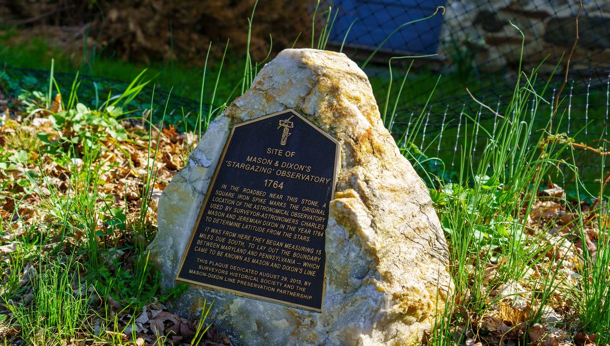
Who were Mason and Dixon?
Both hailing from Great Britain originally, neither Charles Mason nor Jeremiah Dixon came from wealth or lofty social positions.
Mason, the son of a baker, came from a village in Gloucestershire so small that nobody is sure where he could have gotten educated. We do know that he had two wives and eight children, one of whom was baptized by the ambitious name of Doctor Isaac – not important to the story of the Mason-Dixon line, just a weird thing to learn.
Dixon, meanwhile, seems to have been most famous in his hometown – Cockfield (yes, really), in County Durham, right in the north of England – for being the World’s Worst Quaker. “Jeremiah’s behavior was not all it should have been,” wrote H. Wheeler Robinson, then librarian of the Royal Society. “The following entry appears in the Quaker Minute Book of Raby; under the date of 28 October 1760: Jery Dixon, son of George and Mary Dixon of Cockfield disowned for drinking to excess.”
“In this he had apparently inherited a family weakness, for his father on many occasions repented of his ‘loathsome practice of Gitting too much Drink’,” Robinson added. “This was the period when gin drinking was at its height and it may be that the habit acquired by both father and son undermined their health so much as to lead to their early deaths.”
Despite their disparate origin stories, the pair were thrown together for the first time in 1761, just two years before they would start work on their eponymous line. Having been matched by mutual acquaintances at the Royal Society, the two men were sent to Sumatra to observe and record that year’s transit of Venus, and despite a series of mishaps – owing to an attack at sea by the French, they missed the transit at first and had to watch from the Cape of Good Hope instead – the mission was a success. “The observations of the transit of Venus made by Mason and Dixon at Cape Town were used at once […] for comparison with observations made at other stations and for computing the solar parallax,” noted Robinson, along with historian of science Thomas Cope, in 1951.
“They continued to be referred to […] [for] more than a century later.”
Why was the Mason-Dixon line so important?
For obvious reasons, then, Mason and Dixon were best known as astronomers in 1763, when they signed on for a job resolving an ongoing boundary dispute between the provinces of Pennsylvania and Maryland.
“The stakes were very high,” David Thaler, a Maryland engineer and surveyor, and an expert on the Mason-Dixon project, told the BBC in 2017.
“There was about 4,000 square miles [10,400 square kilometers] of territory that was in dispute,” he explained, “and nobody knew who to pay taxes to. Warfare regularly broke out along the border.”
And the problem was more thorny than simple greed. Both sides had a pretty good claim to the land they were fighting over: Maryland’s northern border and Pennsylvania’s southern one – not to mention where Delaware began and ended – were in theory identical, but had in fact all been described in different and overlapping ways.
First, there was Maryland, which had since its creation in 1632 been defined as the land north of Virgina “which lieth under the Fortieth degree of north latitude”. The southern boundary of Pennsylvania, meanwhile, was a bit more cryptic: it was, according to the colony’s 1681 charter, “a circle drawne at twelve miles, distance from New Castle Northwards, and Westwards vnto the beginning of the fortieth degree of Northerne Latitude; and then by a straight line Westwards, to the limit of Longitude above menconed.”
The reason for this peculiar border was simple: Delaware. Specifically, New Castle, Delaware, where there was already an existing Dutch colony. No problem, Charles II thought: we’ll just draw a circle 19 kilometers (12 miles) in radius around that town, and where it connects with the 40th parallel north, that’s the boundary of Pennsylvania. To make sure Pennsylvania has some access to the ocean and rivers, we’ll lease them a few counties on the Delaware peninsula, and boom: no overlap with Maryland; no overlap with any Dutch settlers; everyone’s happy.
Well, perhaps they shouldn’t have been so hasty. In fact, there were a few problems with this setup.
First of all: those counties in what is now Delaware? They were located on land that was theoretically owned by Maryland – the province had never actually exerted any power there, because it had been controlled by the Dutch for the past half-century, but England had recently kicked them out.
If Maryland thought they could just reabsorb that territory, however, they were in for a fight: the Dutch may not be in power anymore, but their legacy remained, and the people who had settled in the region were dead set against living in a Catholic province.
Then it turned out that the 19-kilometer circle – parts of which are still obvious in the states’ borders today – doesn’t even intersect with the 40th degree latitude. In other words: the borders of Pennsylvania didn’t actually join up.
Finally, just to add an extra little knot to the whole tangle, it was discovered that Philadelphia – already the capital city of the Pennsylvania colony – lay south of the 40th parallel, and therefore technically in Maryland. Basically, the whole thing was a mess.
They needed a solution.
Drawing the Mason-Dixon line
It must have been a daunting prospect for the two surveyors, as they set out on their new mission. Not only was this a diplomatic mission, crucial for establishing peace between the two provinces, but it was also an ambitious scientific venture – the first ever geodetic survey in the New World.
“This was the most outstanding scientific and engineering achievement, not only of its day, but of the American Enlightenment,” Thaler told the BBC. “It was so advanced for its time. The brains were the best and the technology was the best.”
“It was the equivalent of the Moon landings today,” he said.
Getting the line precise was a task too taxing for contemporary instruments alone – the pair’s own field notes reveal a discrepancy of about 10 minutes between true West and west as shown by their compass. Instead, they had to navigate across hundreds of miles of wilderness, mountains, dense forests, and rivers, using only their knowledge of the stars.
“In many respects the techniques we use today are very similar to those used by Mason and Dixon,” Todd Babcock, a Pennsylvania surveyor, and founder of The Mason and Dixon Line Preservation Partnership, told HowStuffWorks.
“I use the analogy that Mason and Dixon used the constellation of stars to guide them and today we use a constellation of satellites,” he explained.
Armed with just an astronomical clock brought from England, a zenith sector, and a newly-developed instrument named a Bird Transit after its inventor John Bird – likely the guy who had introduced Mason and Dixon originally – the pair painstakingly marked out hundreds of miles of border. They used huge limestone posts, also brought over from England – nobody really knows why they didn’t use local materials – imprinted with a P on one side and M on the other, and every 8 kilometers (5 miles) a “crown stone” was placed, engraved on either side with the coats of arms of the rulers of each province.
But here’s the real question: how did they do?
How accurate is the Mason-Dixon line?
All things considered, the Mason-Dixon line is pretty good. But it could be better.
“They thought at the end of the survey that the stones were accurate to within 50 feet [15.24 meters] of where they should be,” Babcock told the BBC. “But what we’re finding is that some of them are as much as 900 feet [274.32 meters] off the intended line of latitude.”
Still, at its worst, that’s less than two and a half American football fields out – not bad for a couple of guys in the 1700s. And the real kicker? It wasn’t even their fault.
“Using modern GPS equipment we found they progressively went to the south and then started to come back to the north,” Babcock explained. “The reason for that is not because they were inaccurate or because the equipment was faulty. It was actually gravity.”
See, to find the vertical axis, the pair had been using what’s known as a “plumb bob” – basically a weight on a string. The problem, though, is that variations in the landscape – mountains, valleys, and even long-lost ancient glacial sheets – can change how strong or weak gravity is in an area.
It’s not by enough for you or us to feel it, but it was enough to affect the plumb bob.
“We have found there was a direct correlation between the local variations in gravity and how far north or south of the line they were,” Babcock said. And it wasn’t just the latitude that was affected: “The distances between the stones is supposed to be a mile,” he added, “but what we’re finding is that they are anything up to 15ft [4.6 meters] longer than a mile in places.”
That said, the construction of the Mason-Dixon line – especially given the constraints of the day’s technology – was undoubtedly an incredible achievement. It represented a new scientific dawn in the American continent; it changed the way we understood the shape of the Earth itself; and later on, it would be the gateway to freedom for hundreds of thousands of enslaved Americans.
“The map [Mason and Dixon] produced is one of the most important historical documents we have here in America,” Thaler told the BBC. “It’s almost the equivalent of the Declaration of Independence.”


Source Link: The Weird And Wild Story Behind The Mason-Dixon Line