Typhoon Tip was the largest and most intense tropical cyclone ever documented. In October 1979, it tore through the western Pacific Ocean, with a swirling mass of wind and water vapor that was nearly half the size of the continental US. Imagine half the country swallowed by a single spiraling engine of wind and water.
The seeds of Typhoon Tip were sown the month before. September 1979 was unusually active in the West Pacific, with a string of tropical disturbances lined up from the Philippines to the Marshall Islands. Three of them would grow into typhoons by early October. One in particular, a modest circulation near the Micronesian island of Pohnpei, was destined to become a monster.
How, Why, And When Did Typhoon Tip Get So Big?
At first, it struggled. Competing storms in the Pacific, especially Tropical Storm Roger, sucked away its energy, keeping it weak and hampering its development.
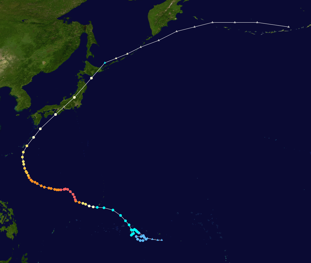
Nevertheless, it eventually mustered enough strength to be designated as “Tropical Depression 23” on October 5. Things escalated quickly. After brushing past Guam on October 9, it turned to the west and officially developed into a typhoon. According to the University of Rhode Island, it was met with some very favorable conditions for intensifying, namely the outflow from Tropical Storm Roger and the presence of a tropical upper-tropospheric trough.

Map of Typhoon Tip’s path, showing the location of the storm at 6-hour intervals.
The numbers at their peak on October 12 are staggering. Tip’s central pressure plummeted to 870 millibars (25.69 inHg), one of the lowest sea-level pressures ever measured on Earth. Its winds screamed at 306 kilometers (190 miles) per hour, which is extremely fast, albeit not record-shattering.
Thankfully, its most explosive moments were spent over the open Pacific, far from major population centers. But the storm didn’t stay at sea forever. As Tip crept north, it veered west toward Asia, then hooked back east, shifting its track toward Japan.
Impact Of Typhoon Tip
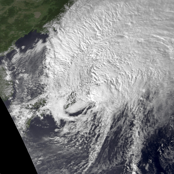
On October 19, the beast made landfall on Honshu, Japan’s largest island. By then, it had weakened, but not nearly enough. Winds still blasted at 129 kilometers (80 miles) per hour, unleashing floods and destruction across the region.
Heavy rainfall produced over 600 mudslides and flooded more than 22,000 homes, leaving thousands homeless. As per Weather Works, a total of 42 people died in Japan as a result of the carnage caused by Typhoon Tip.
Guam was also heavily affected in the midst of the mayhem. The US island territory is home to Camp Fuji, a training facility for the Marine Corps. The storm caused a rubber fuel tank at the base to rupture, sending large amounts of flammable gasoline into a marine barracks area. It caught alight, and the subsequent fire killed 13 Marines and injured 68 more.

Satellite Imagery Of Typhoon Tip over Japan on October 19, 1979.
Image credit: NOAA
Typhoon Tip maintains the record for the largest tropical cyclone (in terms of radius of winds from the storm’s eye), but there have recently been some competitors. In November 2013, the gusts of Super Typhoon Haiyan slammed into the southern Philippines at 315 kilometers (196 miles) per hour, the highest recorded wind speed for a tropical cyclone at landfall. It was also one of the deadliest and most catastrophic cyclones of recent memory, killing over 6,300 people and destroying the homes of 4 million.
Are Larger Tropical Storms Possible?
Even larger storms are perfectly possible, though. Meteorologists have estimated that wind speeds could theoretically have up upper limit of around 354 kilometers (220 miles) per hour. In 2015, Hurricane Patricia came very close to that, with 1-minute sustained winds of 346 kilometers (215 miles) per hour.
It’s also well-established that the warming temperatures from climate change are increasing the intensity, rate of rainfall, and the likelihood of rapid intensification of tropical storms. In essence, more heat over the oceans means more fuel to generate gnarly storms.
The influence is so significant that scientists have suggested we need to introduce a new category – Category 6 – to define hurricanes and typhoons that have wind speeds exceeding 309 kilometers (192 miles) per hour. Since 2013, at least five storms have already reached the hypothetical Category 6 threshold: Hurricane Patricia, Typhoon Meranti, Typhoon Goni, Typhoon Haiyan, and Typhoon Surigae – and they are unlikely to be the last.
Source Link: Typhoon Tip: The Largest Storm Ever Could Have Swallowed Half Of The Continental US