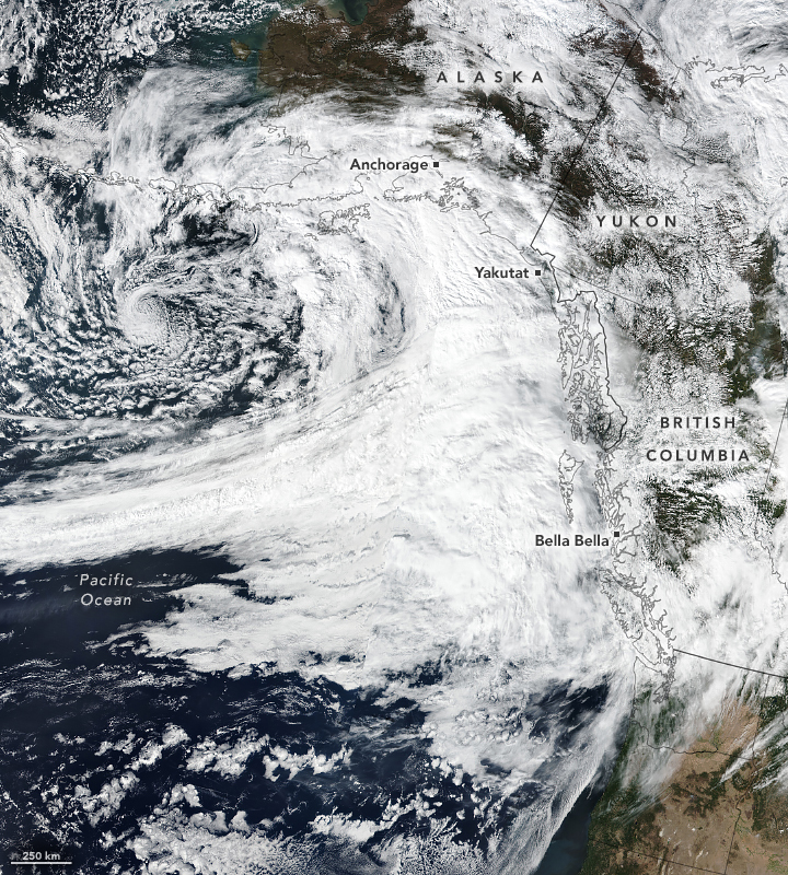
Canada and parts of the US were hit with some serious rainfall earlier in September, and now we might know why – it’s suspected to have been the result of one of the most intense atmospheric rivers seen in the northeast Pacific since 2000.
Atmospheric rivers are often described as “rivers in the sky”; they’re narrow, flowing columns of condensed water vapor up in the atmosphere that can stretch over 2,000 kilometers (1,243 miles) long. When they reach land, that water vapor cools down and is dumped below in the form of rain or snow.
For the most part, they’re pretty weak and provide a benefit to the water supply with the precipitation that they bring.
But when one such column made its way through the Gulf of Alaska in late September, it was unusually powerful, with coastal regions of Canada and southeastern Alaska lashed with heavy rains for several days.
Satellite imagery of the atmospheric river as it made landfall.
Image credit: NASA Earth Observatory
The heaviest was seen in the Coast and Hazelton Mountains and Glacier Bay National Park, but one small town in British Columbia saw four consecutive days with rainfall between 56.2 and 99.3 millimeters (2.2 to 3.9 inches) each day. For reference, the same town received a total 118.7 millimeters (4.7 inches) of rain across the entire month of September in 2023.
In fact, when it made landfall, this particular atmospheric river was what’s known as a Category 4 or 5 – 5 being the highest category there is. Category 5s are also known as “exceptional” and are considered to be primarily hazardous rather than beneficial – meaning that they could come hand in hand with flood risk.
A bit like the Saffir-Simpson scale used for hurricanes, this relatively new system of categorization – it was set out in 2019 – is based on the atmospheric river’s maximum intensity and duration.
One of the defining calculations made in the scale is that of integrated water vapor transport (IVT), which combines wind speed and atmospheric moisture levels to provide an indication of the atmospheric river’s intensity.
As reported NASA Earth Observatory, when scientists at the Center for Western Weather and Water Extremes at the University of California, San Diego initially calculated the IVT for the recent atmospheric river event, the result was an intensity that was particularly high compared to others seen in the region over the last 23 years.
Atmospheric scientist Bin Guan told NASA Earth Observatory such intensity was “remarkable”. But what caused it?
According to Guan, it might have been changes in a climate pattern known as the Arctic Oscillation that are usually rare to see in September: “This could be one of the conditions that potentially contributed to this exceptionally strong atmospheric river event.”
Source Link: Unusually Strong Atmospheric River Could Be Among Most Intense Seen In 23 Years
