


The European Space Agency’s Biomass mission took to the sky on April 29 on a Vega-C satellite launched from French Guiana. Its scientific work will soon start, and it is set to revolutionize what we know about the Earth’s forests and the carbon that is stored within.
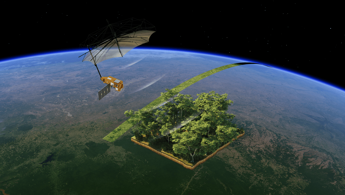
The mission is the first ever satellite to have equipped a P-band synthetic aperture radar. The reason why this is exciting is that radio waves at those wavelengths can see through the forest canopies and so track the woody biomass underneath – the trunks, the branches, and stems – with a resolution of 50 meters (164 feet). The satellite is literally not seeing the forest for the trees.
The mission will deliver crucial information on how much carbon is stored in forests and how much they contribute to and impact the carbon cycle and the climate, information that at this point remains limited. The mission was proposed almost 20 years ago to the day, and now it will finally conduct this vital research.
“Our idea was to use a very special type of radar to map the world’s forests from space. The goal was to understand how forests affect the climate – and how climate change affects forests,” one of the mission proposers, Lars Ulander, Professor of Radar Remote Sensing at Chalmers University of Technology, said in a statement.
These feelings are shared by another proposer of the mission, Professor Shaun Quegan from the University of Sheffield, who explained in another statement: “It’s been a privilege to have led the team in the development of a pioneering mission that will revolutionise our understanding of the volume of carbon held in the most impenetrable tropical rainforests on the planet and, crucially, how this is changing over time. Our research has solved critical operational scientific problems in constructing the Biomass satellite.”
The ESA mission team is now undertaking critical maneuvers to deploy the mesh reflector that is 12 meters (39 feet) across, supported by a boom that is 7.5 meters (25 feet) long. Once this operation is concluded, the spacecraft will begin its tracking. From an altitude of 666 kilometers (414 miles), Biomass will produce continuous global maps, tracking changes with the seasons and with time.
“I’d like to extend my congratulations to everyone who has been involved in developing and launching this extraordinary mission. Biomass now joins our esteemed family of Earth Explorers – missions that have consistently delivered groundbreaking discoveries and advanced scientific understanding of our planet,” ESA’s Director of Earth Observation Programmes, Simonetta Cheli, said in a statement.
“With Biomass, we are poised to gain vital new data on how much carbon is stored in the world’s forests, helping to fill key gaps in our knowledge of the carbon cycle and, ultimately, Earth’s climate system.”


Source Link: World’s First Mission To "Weigh" All Of Earth's Forests From Space Launches