As wildfires continue to rage across Southern California, forecasters have warned of a powerful force worsening the situation: Santa Ana winds, aka devil winds.
Santa Ana winds are extremely warm, strong, and dry winds that occur when air from a region of high pressure over the arid desert areas of the southwestern US flows westward toward a low-pressure system off the Californian coast.
Named after Southern California’s Santa Ana Canyon, they typically occur in the cooler months from September until May. The hot streams of winds have been particularly strong in the past few weeks and have helped to fuel the ongoing wildfires in Southern California by providing oxygen and creating arid conditions with very low humidity.
“Air will move from high to low pressure and, in the case of the Santa Anas, this means that really hot, dry air moves from the desert up over a series of mountains. Every time that air descends towards the coast, it gets hotter due to an increase in pressure,” Amy Hessl, a geography professor and paleoclimatologist at West Virginia University, said in a statement.
“Many fire scientists and firefighters believe that the Santa Anas produce the most extreme fire conditions anywhere in the world.”

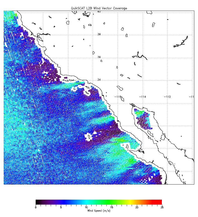
Data from October 2007 shows a Santa Ana wind event in Southern California creating high wind speeds off the coast.
Image credit: NASA/JPL
In the first weeks of January 2025, San Bernardino County endured an “extreme Santa Ana wind event” that saw hurricane-force winds of up to 128 kilometers (80 miles) per hour, forcing the area to extend its red flag warning for fire danger. More winds are forecast for this week, likely escalating the already dire situation
“We could face another round of hurricane-force wind gusts in some places this week. Powerful wind gusts could ground some firefighting aircraft at times, which makes it more difficult for crews to contain wind-driven fires,” Alex DaSilva, AccuWeather Meteorologist, said in a statement sent to IFLScience on Monday.
“Embers carried in the wind can quickly spread these fires in suburban areas from house to house. People need to be packed up and ready to evacuate in a matter of moments.”
Coupled with the relentless devil winds, parts of California have endured an exceptional lack of rainfall over the past year. This prolonged dryness has parched the landscape, creating ideal conditions for wildfires to ignite and spread rapidly.
“Dating back to April of last year, Los Angeles has not yet crested the 1-inch mark for rainfall. This is a period when downtown L.A typically receives between 5-6 inches of rain,” Alex Sosnowski, Senior Meteorologist at AccuWeather, said in a Tuesday statement sent to IFLScience.
“There could be a shower or two Jan. 18-19, but it is not expected to be meaningful to aid in reducing fire spread or risk. There is another chance of rain Jan. 26-28, but that should also just be a few showers. The best chance of rain over the next six weeks appears to be Feb. 10-23. If appreciable rain doesn’t occur then, it may turn dry into much of March, further exacerbating the situation,” AccuWeather Lead Long-Range Expert Paul Pastelok warned.
Source Link: What Are Santa Ana Winds, The "Devilish" Gusts Fueling California's Wildfires?