The longest land border in the world is between Canada and the United States, stretching 8,891 kilometers (5,525 miles). From afar, it appears to be a relatively boring border – clean, crisp, and dead-straight – but a closer look reveals this territorial boundary is very strange.
The US-Canada border has two main bits: the long border that cuts horizontally through North America with the contiguous US to its south, as well as another vertical boundary slicing between Alaska and Canada in the continent’s far northwest.
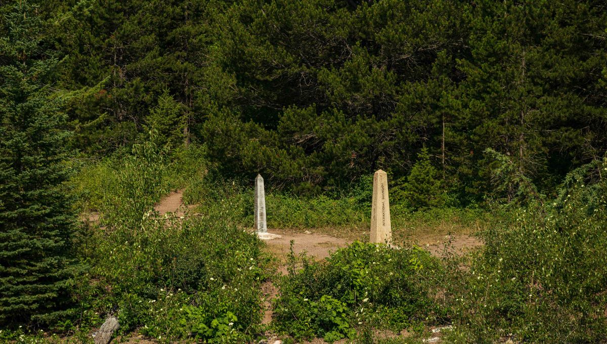
A large section of the horizontal border looks incredibly straight on most world maps. In particular, the 2,027-kilometer (1,260-mile) stretch between Lake of the Woods (Minnesota/Manitoba) and Boundary Bay (Washington state/British Columbia) seems to trace an unwavering path along the 49th parallel north.
In reality, that’s not the case. At ground level, the border wobbles, zigzags, and is peppered with odd quirks.
There are several parts where the US-Canada actually sways off the 49th parallel by hundreds of meters. This doesn’t cause too many issues when it’s over open plains, where much of the “straight line” border sits, but occasionally it leads to complications.
For instance, in the late 1990s, it was revealed that the Canadian border town of Coutts, Alberta, actually extends 363 meters (1,191 feet) into land that should technically fall on the US side of the line. These small shifts are surprisingly common along the 49th parallel. In fact, it’s estimated that Canada technically holds an extra 67.2 square kilometers (25.9 square miles) of land south of the parallel.
This apparent sloppiness is a reflection of the way the border was drawn up by the Americans, Canadians, and the British in the 18th and 19th centuries through a series of treaties, political chess moves, and dodgy surveys.
After the Louisiana Purchase in 1803, the US and Britain initially decided the boundary between their territories should follow the natural divide between waters flowing into Hudson Bay and those draining into the Mississippi–Missouri system.
But out on the ground, much of the landscape was so flat that it was tricky to determine which way the water actually ran. Realizing this ambiguity could spark future disputes, both nations agreed that the 49th parallel would be the marker.
“It’s not like the British and the Americans had a map and they drew a ruler on it. They didn’t have a map, and they just agreed upon this imaginary line: the 49th parallel. They just projected these imaginary lines further on to a geography that they didn’t know anything about,” Stephen Bown, author of Dominion: the Railway and the Rise of Canada, told The Guardian in May 2025.
Over time, the countries bickered and bargained to affirm the boundary through treaties, such as the Treaty of Ghent after the War of 1812, and the Oregon Treaty (1846), which finally extended the 49th parallel all the way to the Pacific.
However, marking the border was no easy task in the pre-satellite era. Much of the land beyond the 49th parallel was an undocumented expanse, plus the boundary frequently came into conflict with natural features that refuse to be bracketed by a straight line, such as rivers and lakes to mountains and forests. Instruments were far from precise, too, so tiny errors accumulated over hundreds of miles.
These blunders left a real impact on the way people live along the border. Just take a look at Point Roberts, Washington, where a small piece of the US can only be reached by land by crossing into Canada. Similarly, the Northwest Angle is an exclave of Minnesota that is completely surrounded by Canada, thanks to miscalculations by mapmakers back in London.
The good news is that the US and Canada have historically been close friends, meaning their slightly awkward boundary rarely causes trouble that requires the military to get involved. Even serious trade disputes or threats of annexation haven’t turned this strange border into a full-blown point of conflict – at least yet.
Source Link: What's The Longest Border In The World? It's A Lot Weirder Than It Looks On A Map