Jungle-piercing lasers have revealed the lost traces of an 18-kilometer (11-mile) long highway that connected Maya cities over 1,200 years ago.
The giant sacbé (white road, in the Mayan language) was recently discovered by Mexico’s National Institute of Anthropology and History (INAH), which used LiDAR-armed drones to cruise over the Puuc region in the state of Yucatán.
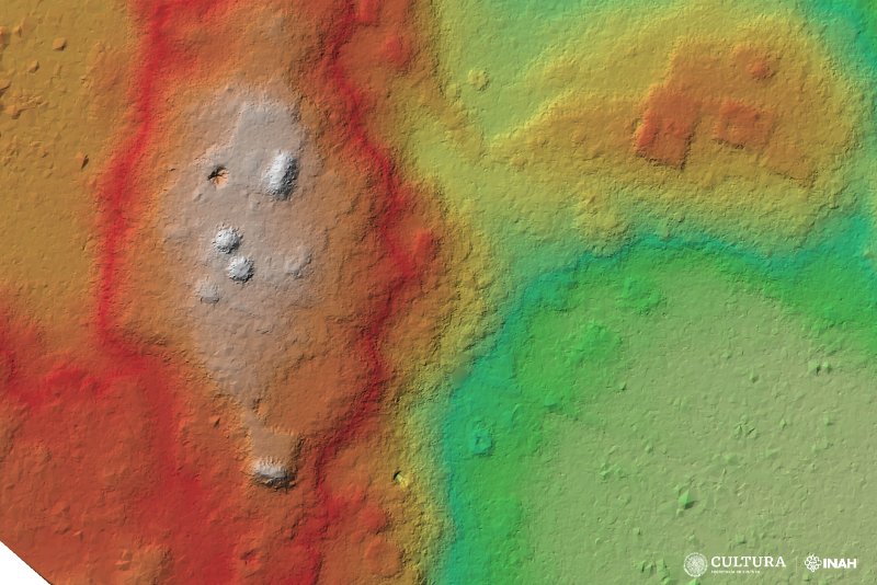
By scanning some 190 hectares (470 acres) of the region, archaeologists picked up on impressions that appear to be a lengthy road between the Maya cities of Uxmal and Kabah. The newly discovered road likely linked the two settlements for over 250 years between 700 and 950 CE when the cities were enjoying their heyday.
Large archaeological ruins of these grand cities still remain today, including the Pyramid of the Magician at Uxmal and Kabah’s vast Codz Poop palace (yes, that is its real name). As many as 25,000 people once lived in Uxmal and wandered around its highly decorated streets featuring many symbolic motifs and sculptures of Chaac, the god of rain.
While a fair deal is known about Uxmal and Kabah, archaeologists had little idea about the mega-highway connecting the two until now.

The traces of the road, seen in the red parallel lines in this image.
Image credit: INAH/Uxmal Archaeological Zone.
The road is just one arm of a larger network that connected the Maya world centuries ago. It’s known there is another road that crosses the sites of Nohpat and Chetulix, two other Maya cities in the Puuc region. Furthermore, in 2020, another road was discovered between Cobá and Yaxuná, connecting the two cities and thousands of people who lived in the intermediary Puuc region.
These discoveries were made possible by LiDAR, which stands for Light Detection and Ranging, a remote sensing technology that’s helping to revolutionize archaeology and the rediscovery of long-lost structures. The tech uses laser light to measure distances and generate precise, three-dimensional information about the shape and characteristics of objects, which might otherwise be hidden by vegetation.

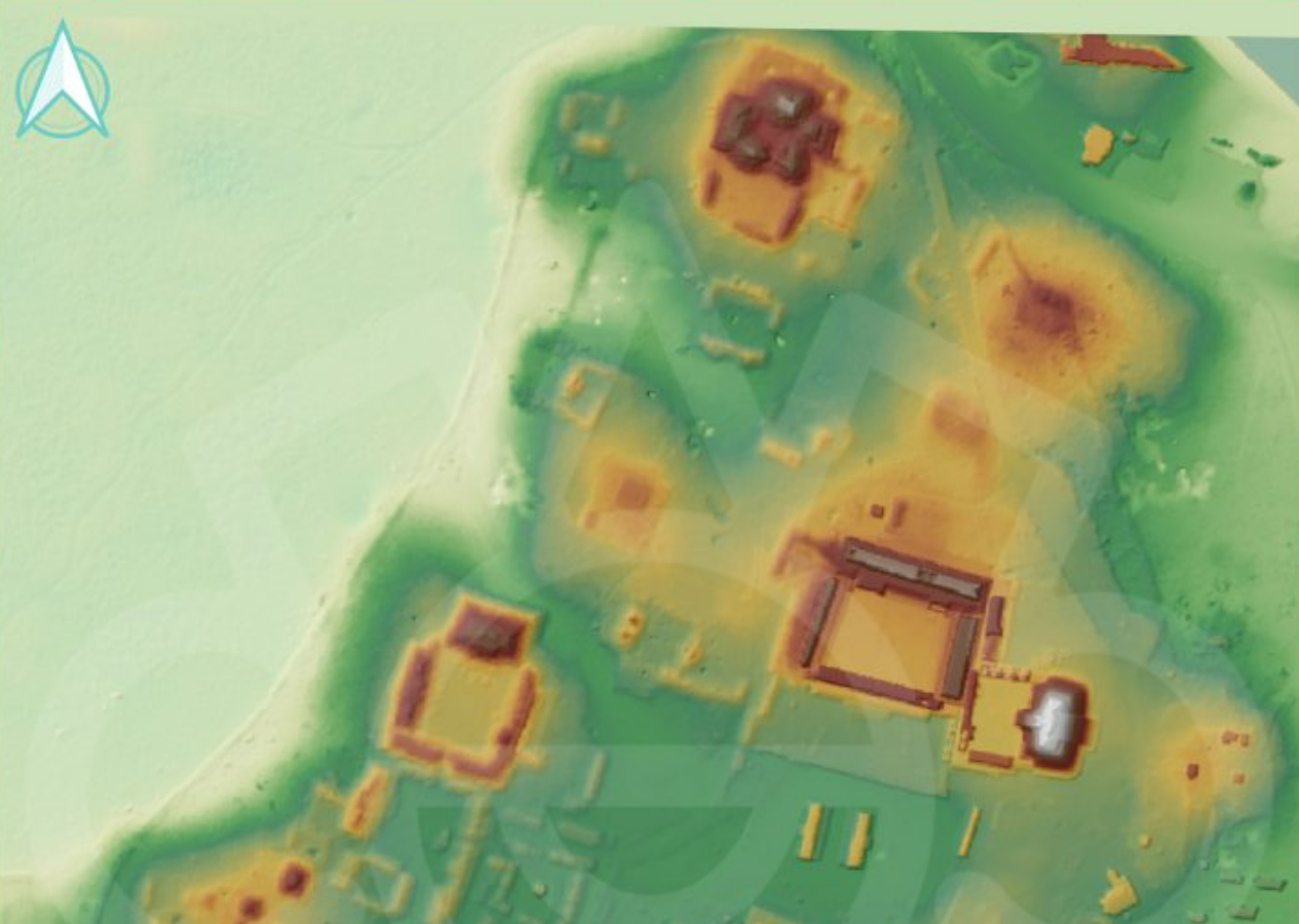
LiDAR is revealing that the cities of Uxmal and Kabah were closely linked by roads.
Image credit: IMAH/Uxmal Archaeological Zone.
Along with roads, LiDAR imaging has helped to reveal sophisticated, sprawling empires. In the rainforests of present-day Guatemala, archaeologists used imaging technology to confirm the presence of more than 61,000 Maya structures, including houses, large palaces, ceremonial centers, and pyramids.
Just like those settlements in the Puuc region of modern-day Mexico, these settlements were deeply intertwined with one another. LiDAR imaging has revealed evidence of a previously unknown Maya civilization made up of 964 interconnected settlements linked together with 177 kilometers (110 miles) of ancient roads.
All of these findings are strong reminders the pre-Columbian world was a rich and deeply complex place in the centuries before it met its untimely end in the 17th century with the arrival of the Europeans.
Source Link: Lost 18-Kilometer Maya Road Revealed By Jungle-Piercing Lasers