What do you get when 100 million cubic meters (3.5 billion cubic feet) of land suddenly plunge into an icy Alaskan fjord? Some big-ass waves, it turns out – including one that was taller than all but one of the highest buildings in New York City.
That’s what happened back on August 10 this year, when a massive landslide occurred in Tracy Arm – a fjord about 130 kilometers (80 miles) south of Alaska’s state capital, Juneau – at around 5:30 am local time. Massive isn’t an overstatement, either.
“I feel pretty comfortable saying that anything that was actually at the terminus of this glacier, right at the base of this landslide, would have been absolutely obliterated,” state seismologist Michael West told Alaska Public Media. “I cannot see any way around that.”
“Fortunately, we do not have reports of folks who were really close to the slide, say, you know, within a mile or something, but I can only imagine that would have been an extremely violent affair,” West added.

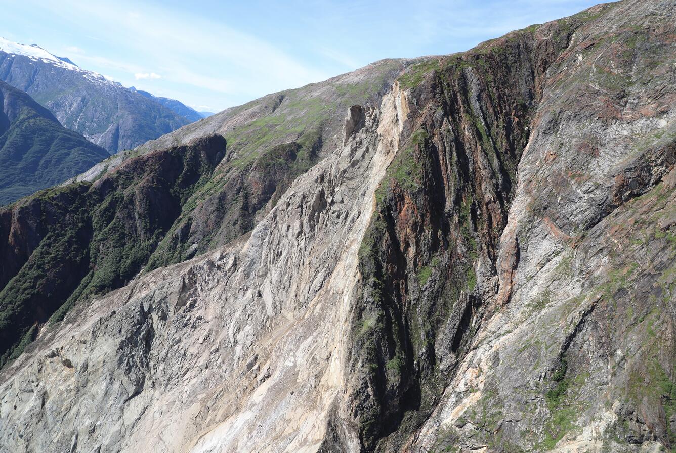
There’s a chunk of hillside missing here.
Image credit: USGS (public domain)
But miles south, near the entrance to the Fords Terror fjord, cruise ship owner Christine Smith noticed something was up. “[W]e started seeing the water rising again on what should have been a falling tide,” Smith told Alaska Public Media. “We knew something was really different, and wrong.”
It was at that point that she got in touch with a seismologist, who in turn contacted the Alaska Earthquake Center and US Geological Survey (USGS). Sure enough, research scientists at the center found evidence of a landslide in the area, with the signal detected by seismic stations over 1,000 kilometers (620 miles) away.
What soon became clear from further investigation was that this landslide had also triggered a megatsunami. Although it wouldn’t be advisable to be up close and personal to such an event – some kayakers camping on an island at the mouth of the fjord had their gear swept away, but luckily made it out safely – the initial wave of water created by the landslide would’ve been pretty spectacular to witness.
Early estimates made using GPS and altimeter readings taken from scientists on a helicopter put the wave’s run-up (the maximum height the wave reaches on land) on the opposite hillside somewhere between 470 and 500 meters (1,541 to 1640 feet) in height. If we compare that to the skyscrapers of New York City, the first wave was higher than all but the One World Trade Center, the city’s and the USA’s tallest building.
It was far from the last of the waves either; data from the event suggests that the tsunami created something called a seiche, where a standing wave moves back and forth within an enclosed space. According to the Alaska Earthquake Center, this sloshing back and forth occurred once every minute for 35 hours after the landslide occurred.
Though the wave wasn’t quite record-breaking – the tallest tsunami on record, which also occurred in Alaska, was 24 meters (79 feet) higher – that’s not to say it didn’t have an impact. Images taken in the days after show the sheer scale of the devastation wrought by the event, which is likely to have long-lasting effects.

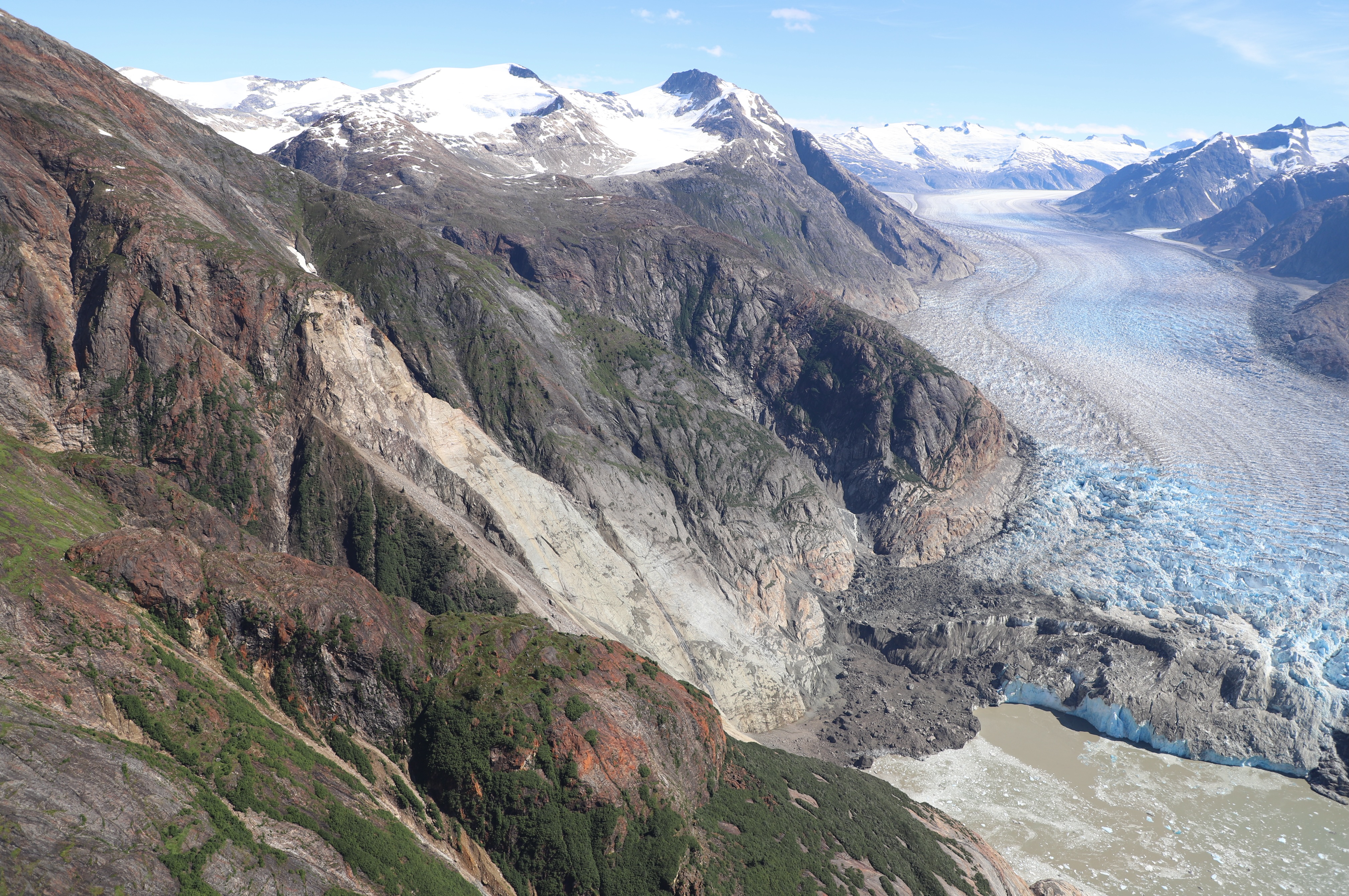
The landslide occurred near the South Sawyer Glacier, seen on the right.
Image credit: USGS (public domain)
“Steep, mountainous landslide areas are inherently unstable and will continue to change for years following an initial landslide. Continued rockfall and smaller-scale landslide events from the exposed landslide scar are expected and could impact the water, potentially causing future local tsunami. As such, this area remains hazardous,” said the USGS.
Source Link: 500-Meter-Tall Megatsunami Struck Remote Alaskan Fjord After Massive Landslide